
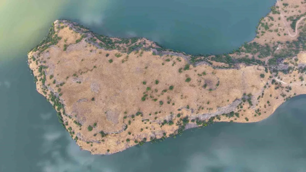
A 3,000-year-old fortress covering roughly 120,000 square meters has been identified near Mescidli village in eastern Turkey, revealing one of the largest fortified sites yet recorded in the Muş region. Its walls stretch for about 1.4 kilometers, enclosing an area comparable to 17 football fields.
The scale would be remarkable on its own, but archaeologist Melik Mirbey Ömeroğlu believes the site may also belong to the formative period of the Urartian kingdom. He has raised the possibility that the fortress could be connected with Arzashkun, the royal city of King Arame, whose location has remained unresolved since Assyrian texts first recorded its destruction in the ninth century BCE.
If that connection proves correct, the discovery would reach far beyond the identification of another Urartian fortress. Arzashkun belongs to the poorly understood period before Tushpa, modern Van, emerged as the kingdom’s great political center, making the site potentially important for understanding how Urartu first took shape.
A Fortress Hidden in Plain Sight
The sheer size of the site raises an obvious question: how could a fortress covering 120,000 square meters remain unidentified for so long? The answer appears to lie in the way the ruins survive across the landscape.
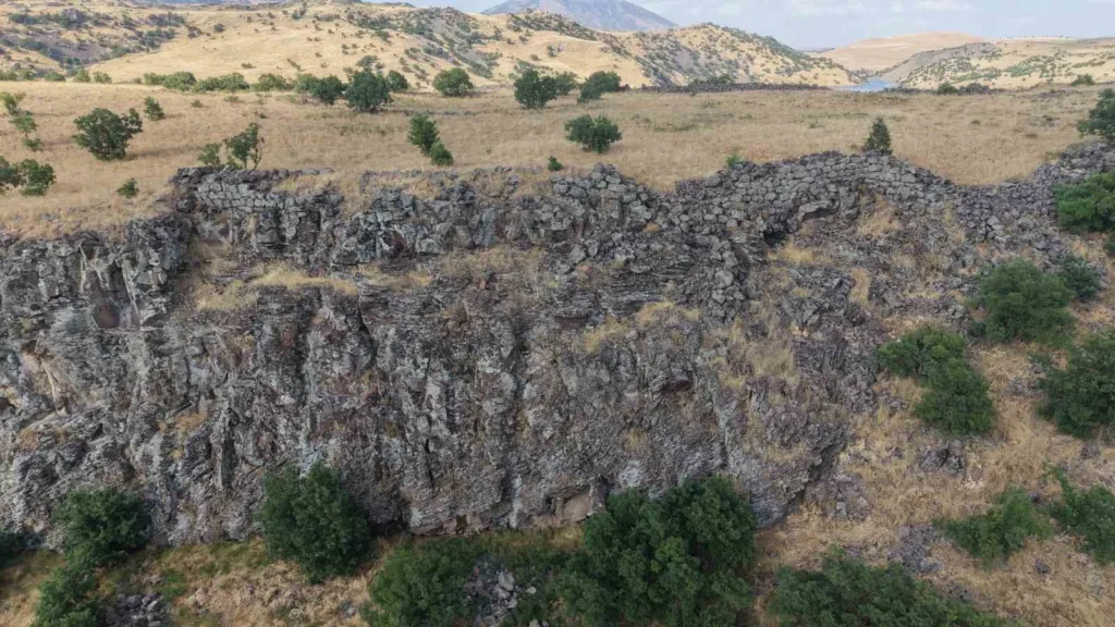
Much of the architecture has collapsed and blended into the surrounding terrain. From ground level, isolated wall sections and scattered stonework can resemble natural formations rather than parts of a single monumental complex.
Satellite imagery changed that picture. While examining the Mescidli area from above, Ömeroğlu noticed lines and structural patterns that did not match the natural topography, prompting him to inspect the area directly.
On the ground, those anomalies turned out to form sections of a much larger fortified settlement. By tracing the remains across the landscape, Ömeroğlu could see that the fortifications extended for roughly 1.4 kilometers and enclosed about 120,000 square meters.
Satellite imagery effectively connected ruins that appeared fragmented at ground level into a single archaeological landscape. That wider view helped reveal not just individual walls, but the true scale of the settlement they once protected.
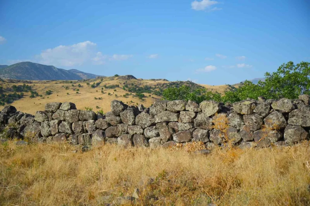
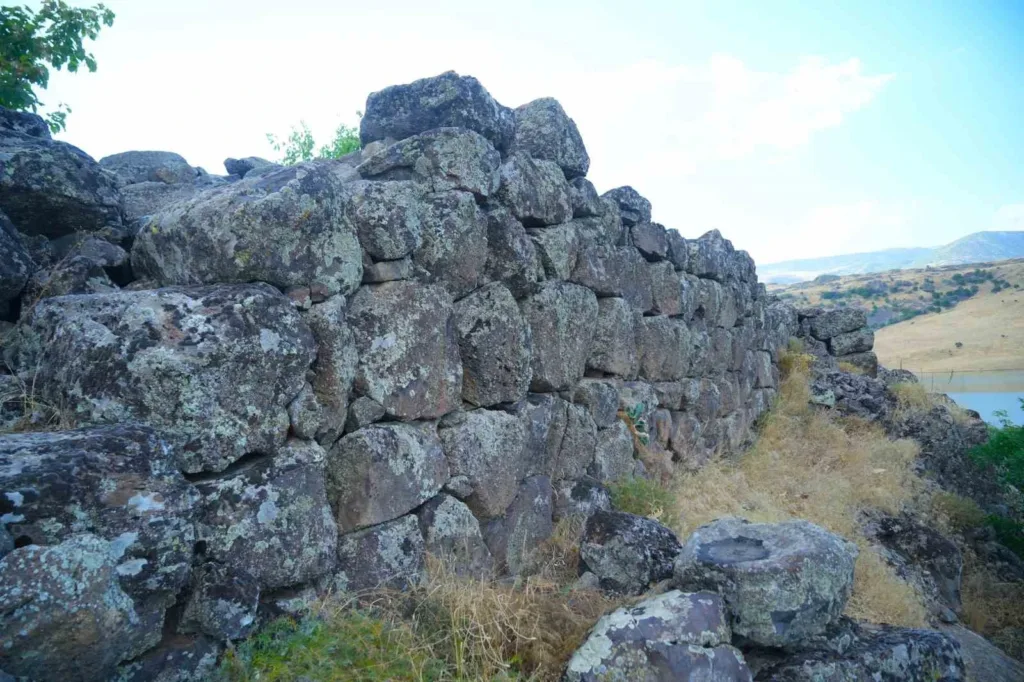
The masonry may also help establish the site’s chronological context. Massive stones form sections of the fortification walls, and Ömeroğlu compares their cyclopean and polygonal construction with Early Iron Age sites such as Aşağı Anzaf and Zivistan in the Van region.
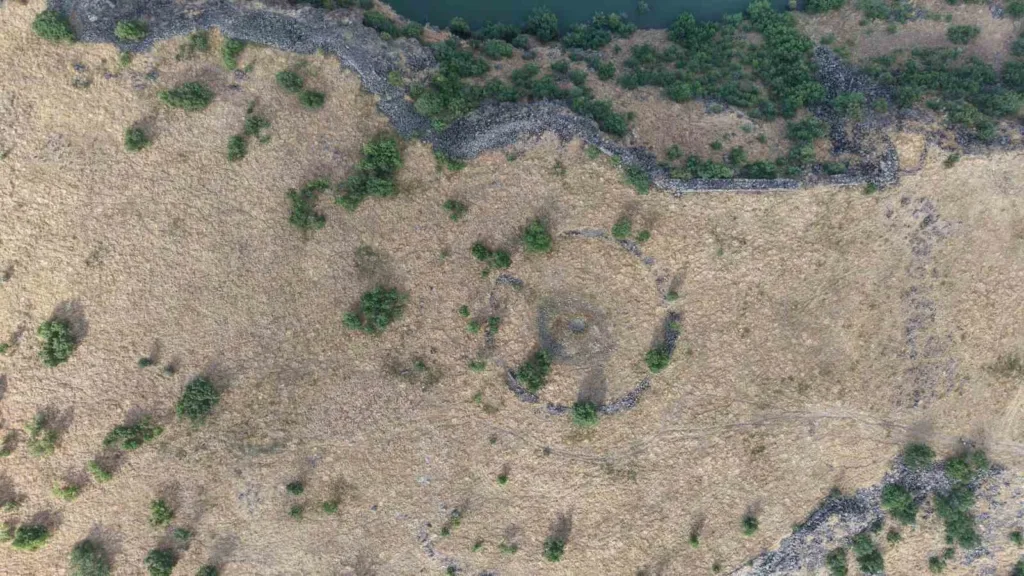
Inside the enclosure, architectural traces remain visible in the northern sector. In the south, a large circular feature measuring roughly 25 meters in radius may have played a role in water management, although its exact function remains unclear.
Together, the walls, internal structures and sheer scale point to something more substantial than a minor military outpost. The site appears to have supported a community large enough to require extensive defenses, internal organization and access to water.
Arzashkun at the Dawn of the Urartian Kingdom
Arzashkun occupies an unusual place in Urartian history because almost everything known about it comes from the kingdom’s enemies. In the ninth century BCE, Assyrian records mention a ruler named Arame, the earliest king clearly associated with Urartu.
Unlike later Urartian rulers, Arame left no known royal inscriptions of his own. Historians therefore reconstruct much of his reign through Assyrian texts written by the kingdom that fought against him.
The annals of the Assyrian king Shalmaneser III describe Arzashkun as Arame’s royal city. During a campaign in 856 BCE, Shalmaneser claimed that his forces attacked and destroyed the city before confronting Arame’s army.
That brief reference gave Arzashkun a lasting place in the history of Urartu. It points to a royal center that existed before Tushpa, modern Van, became the monumental heart of the kingdom.
Later in the ninth century BCE, rulers such as Sarduri I developed Tushpa into a major political center. From there, Urartu expanded its system of fortresses, inscriptions, irrigation works and administrative centers across a broad part of eastern Anatolia and the Armenian Highlands.
Arzashkun belongs to the less visible stage before that transformation. Finding it could help archaeologists understand how an emerging regional power developed into the highly organized Urartian kingdom known from the eighth and seventh centuries BCE.
The Royal City That Disappeared
Despite its importance in Assyrian accounts, archaeologists still do not know where Arzashkun stood. Scholars have proposed several locations over the years, including areas around Lake Van, Malazgirt, and farther east toward the Lake Urmia basin.
Much of the debate depends on reconstructing Assyrian campaign routes and matching ancient place names with modern geography. That process remains difficult because the texts describe landscapes and settlements that scholars cannot always identify with certainty today.
The fortress near Muş therefore enters an already complex archaeological debate. Its enormous size suggests a settlement of considerable importance, while its location fits a region that played a role in the western sphere of early Urartian expansion.
Ömeroğlu also points to the architectural similarities between the fortress and other Early Iron Age sites. Size, location, and masonry do not identify the site by name, but together they make the new discovery difficult to treat as an ordinary regional stronghold.
A Site Large Enough to Change the Search
Even without a direct connection to Arzashkun, the fortress adds an important new site to the archaeology of eastern Anatolia. A fortified settlement covering 120,000 square meters required significant planning, labor, and resources, suggesting that its builders controlled more than a small hilltop refuge.
The fortifications, internal structures, and possible water installation indicate a settlement designed for prolonged occupation and organized activity. Future excavation could clarify when people first built the fortress, how long they used it, and whether its occupants had direct ties to the earliest Urartian rulers.
Pottery, radiocarbon samples and architectural sequences could narrow the chronology. An inscription would provide something even more valuable by potentially identifying the people, rulers, or administrative system connected with the site.
For now, the discovery has brought Muş into one of the longest-running debates in Urartian archaeology. Arzashkun still survives only in ancient Assyrian records, but the newly identified fortress now offers researchers a substantial new place to investigate in the search for Urartu’s earliest royal center.
Ömeroğlu has also applied to the Van Regional Board for the Protection of Cultural Heritage to have the site officially registered and protected. That step could help secure the fortress while researchers work to establish its chronology, function, and possible place in early Urartian history.
