
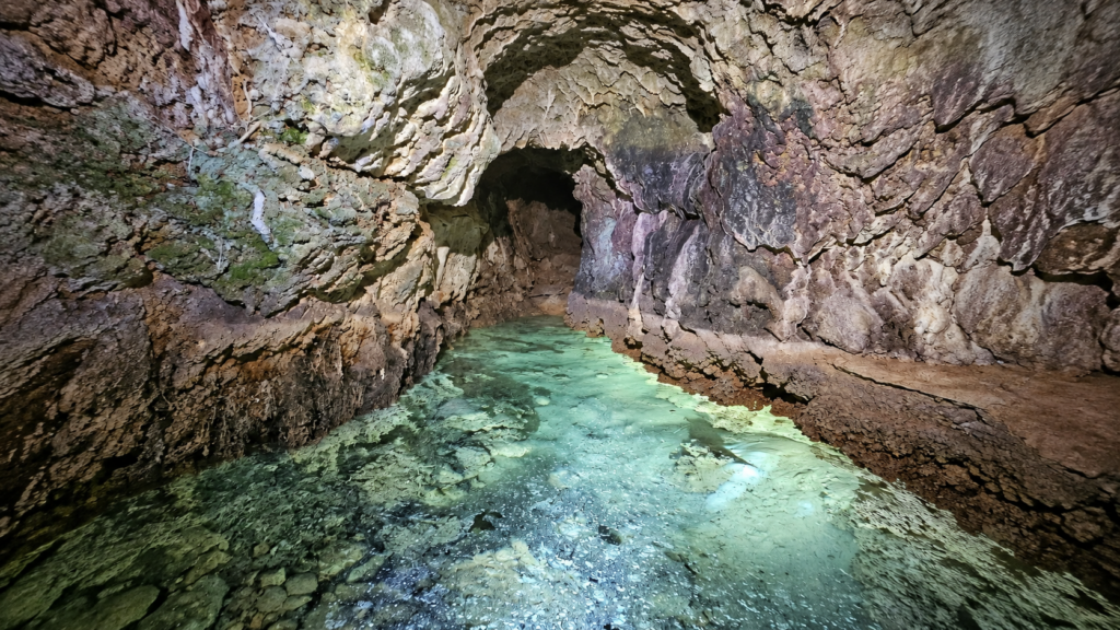
Long before the Romans built their famous aqueducts, communities in central Italy were already developing remarkable ways to control water. A recent discovery in the hills of Monteleone Sabino, northeast of Rome, has brought one of these ancient engineering achievements to light: a pre-Roman aqueduct carved entirely into solid rock, with an underground passage at least 100 meters long.
Beyond its impressive construction, the aqueduct provides insight into the lives of the Sabines, especially the Mutuesci community that once thrived in this region of Italy. Their settlements, farming techniques, and spiritual customs played a significant role in shaping the area long before it was incorporated into the Roman Empire.
Italy’s Superintendence of Archaeology, Fine Arts and Landscape for Metropolitan Rome and Rieti (SABAP) announced the discovery in an official statement. The investigation was carried out by the Gruppo Speleo Archeologico Vespertilio under the authority’s scientific direction, in cooperation with the municipality of Monteleone Sabino.
An Underground Passage Cut Through the Hillside
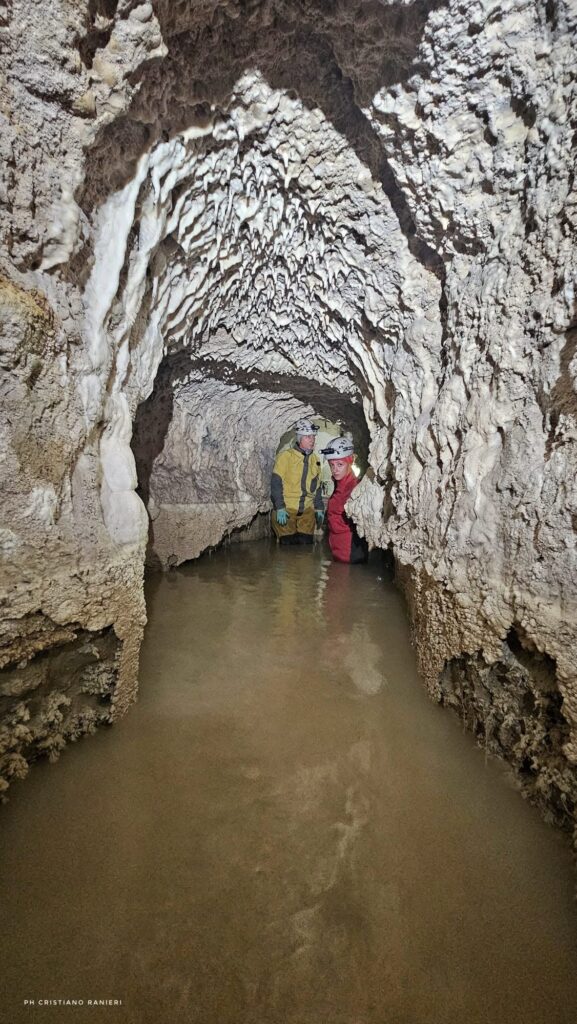
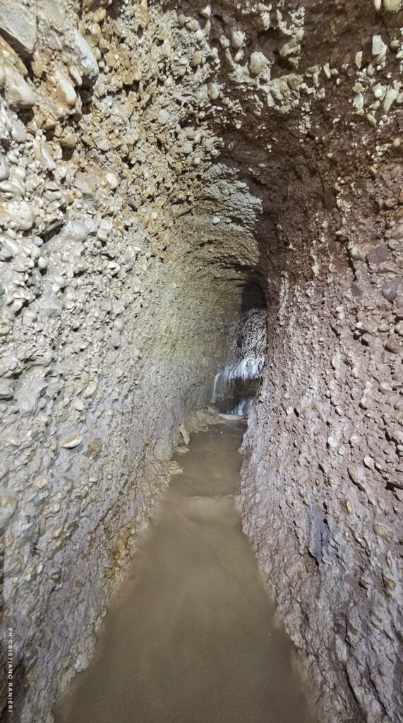
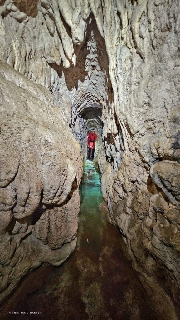
The aqueduct runs through a hillside composed of conglomerate rock alternating with layers of marl and clay. Its distinctive pointed-arch profile follows a design found in other ancient underground water channels across the Sabina region.
What makes the structure particularly remarkable is how its builders excavated it. Rather than beginning at one end and digging continuously through the hillside, they first opened transverse tunnels at regular intervals. They then excavated along the ridge, creating the main underground passage through a carefully organized sequence of work.
This method required an understanding of the terrain and careful coordination between workers operating at different excavation points. The surviving passage preserves evidence of that process, allowing researchers to examine how ancient builders approached a demanding engineering project.
Although the archaeological authority identifies the aqueduct as pre-Roman, it has not established a precise construction date. The approximately 100 meters documented so far represent the accessible section, rather than a confirmed measurement of the original system.
Life in Sabina Before Roman Rule
The aqueduct belonged to a landscape inhabited by the Mutuesci, a Sabine community associated with the ancient settlement of Trebula Mutuesca, near present-day Monteleone Sabino.
The Sabines occupied a substantial part of central Italy before Roman expansion. Their communities lived among the hills and valleys northeast of Rome, maintaining settlements, agricultural land, and religious sanctuaries connected by routes through the Apennines.
The name Mutuesci has survived through the ancient town’s name and written sources. Pliny the Elder distinguished the inhabitants of Trebula Mutuesca from those of another settlement called Trebula Suffenas, showing that the name identified a particular local community.
According to the Civic Archaeological Museum of Monteleone Sabino, some scholars have connected the name Mutuesci with an Oscan-Umbrian linguistic root referring to wet or marshy conditions. The interpretation remains uncertain, but it offers an intriguing connection with a landscape where controlling water was essential to agriculture.
The area was also known for its olives. In the Aeneid, Virgil called Mutusca olifera — olive-producing — offering a brief glimpse of an agricultural tradition already associated with the place in Roman literature.
Trebula Mutuesca occupied a favorable location near routes connecting the Tiber Valley with the interior Apennines. The nearby Via Salaria, an ancient road associated with the salt trade, helped connect the Sabine countryside with Rome and regions farther east.
A Community That Built More Than Water Channels
In ancient central Italy, rural populations often lived in territorial districts known as pagi (singular: pagus). These districts brought together smaller villages and settlements, called vici, whose inhabitants shared agricultural lands, local traditions, and access to important routes.
SABAP associates the newly documented water channel with one such district inhabited by the Mutuesci, whose communities occupied the countryside between the Apennine interior and the Tiber Valley. Building an extensive underground water system would have required cooperation, skilled workers, and considerable resources, suggesting that these settlements possessed the organizational capacity to manage infrastructure serving a wider agricultural landscape.
Such infrastructure projects required significant investment from the outset. To carry out a project like this, not only were resources and—more importantly—organizational capacity needed, but the workers also needed the expertise to shape and excavate the rock.
Of course, water and agriculture were not the only important elements of this region. Religion also shaped the traditions of the local communities, whose beliefs included the worship of goddesses such as Feronia, associated with nature and fertility; Angitia, linked to healing, snakes, and medicinal plants; and Vacuna, an ancient Sabine deity whose precise role remains uncertain. These beliefs reflected the close relationship between people, the natural world, and the resources on which their daily lives depended.
Archaeologists have unearthed votive offerings in the region—such as terracotta heads, anatomical depictions, and small animal figurines—dedicated to these goddesses. Although the aqueduct is not directly associated with any sacred site or ritual activity, it adds a new dimension to our understanding of a community based on agriculture, local resources, and the surrounding landscape.
Before the Romans Transformed Trebula Mutuesca
The Roman conquest of the Sabine interior traditionally dates to 290 BCE, during the military campaign of Manius Curius Dentatus. Trebula Mutuesca gradually entered the Roman political and administrative system, although its earlier settlement traditions did not disappear immediately.
Even in the second century BCE, writers still referred to Trebula as a vicus, a local settlement. It only became a full Roman municipality under Augustus, when the town began to develop more substantial public buildings.
Later structures included baths, cisterns, drainage systems, and an amphitheater that Emperor Trajan rebuilt in AD 115. Some of these remain visible today and show what the settlement looked like after centuries of Roman influence.
The underground aqueduct, however, points to an earlier time, when the Mutuesci were already cutting into the hillsides to serve the needs of their communities. Previous archaeological work has also turned up ancient hydraulic tunnels around Trebula Mutuesca and along the Via Salaria, suggesting that the newly recorded passage belongs to a wider tradition of underground water management in the region.
The current investigation brings together archaeological study and speleological exploration, allowing researchers to examine structures that lie hidden beneath today’s landscape. Although the exact date, full length, and possible links to other channels are still uncertain, the accessible section provides clear evidence of the technical skill present in pre-Roman Sabina.
For the archaeologists studying Monteleone Sabino, the discovery is not simply another ancient tunnel. It helps recover the history of communities whose engineering achievements were already shaping the Italian countryside long before Roman aqueducts became symbols of an empire.
Soprintendenza ABAP per l’area metropolitana di Roma e la provincia di Rieti (SABAP)
