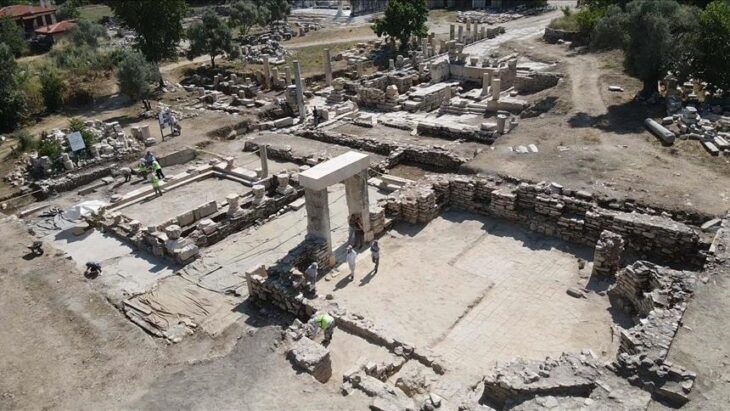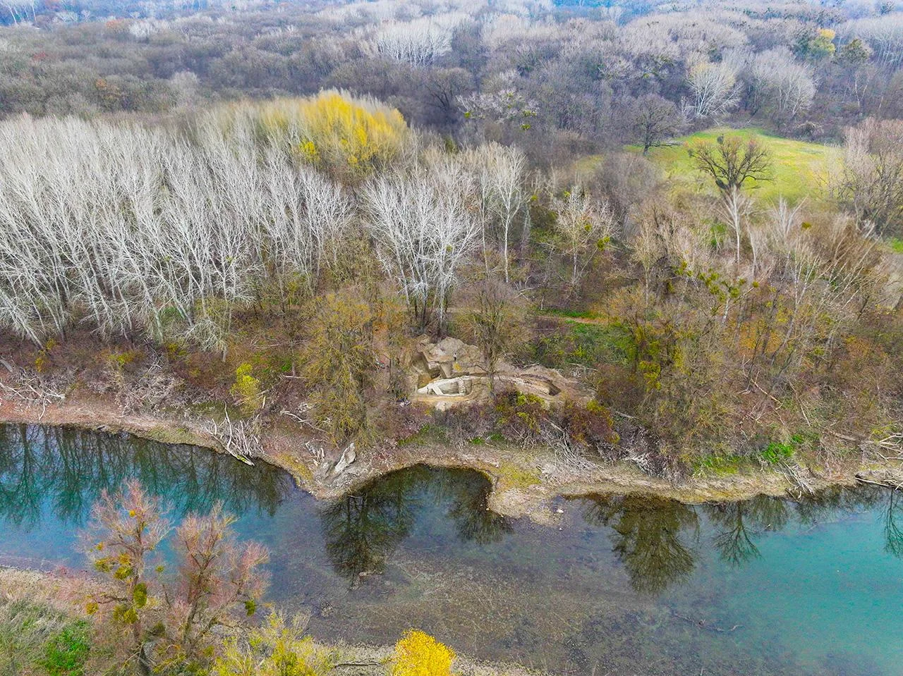
Researchers have identified the first confirmed Roman bridgehead fort in Austria, located near Stopfenreuth on the Lower Austrian Danube floodplains. This significant find, led by the Austrian Academy of Sciences (ÖAW) and the Carnuntum Archaeological Park, sheds new light on the Roman Empire’s northern defense strategies and its control over vital trade routes, including the renowned Amber Road.
Historically known as the “Ödes Schloss” or “Deserted Castle,” the site had long puzzled historians, who speculated whether it was a medieval fortress or a remnant of the 16th-century conflicts with the Ottoman Empire. However, recent excavations have definitively established its identity as a Roman bridgehead fort, strategically positioned to oversee and facilitate the movement of people and goods across the Danube—a natural boundary of the empire and a crucial segment of the Danube Limes, now recognized as a UNESCO World Heritage Site.
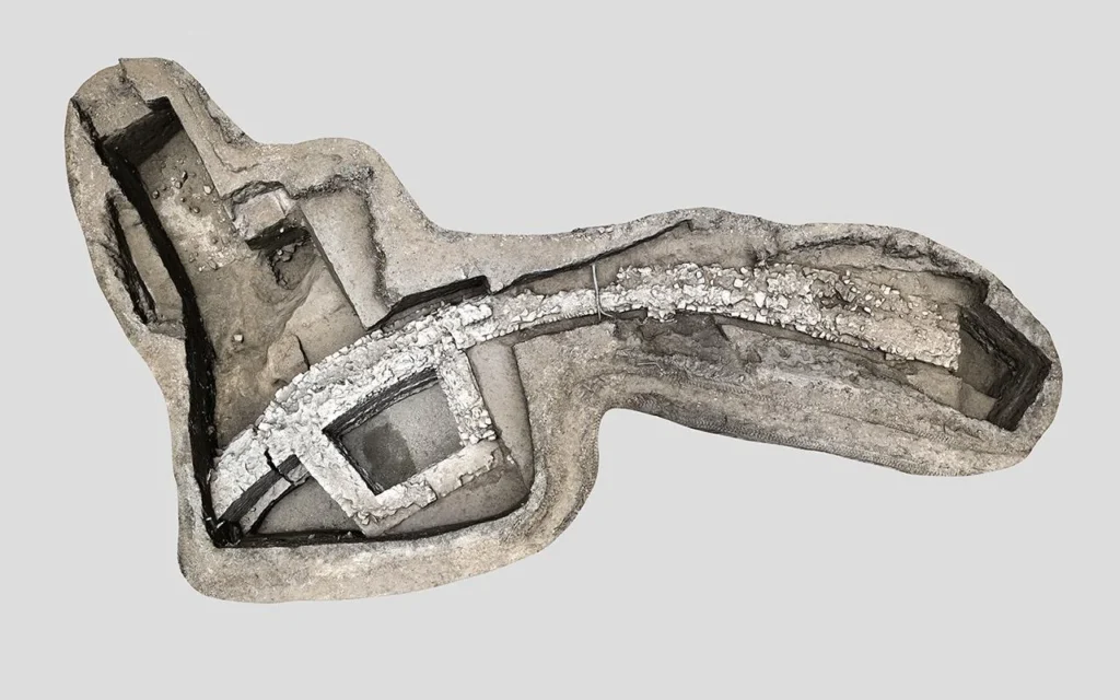
Bridgehead forts were typically constructed on the far side of border rivers, serving as military outposts from which Roman troops could monitor and control strategic areas. The fort near Stopfenreuth was built in two major phases: the first, around 170-180 CE during the Marcomannic Wars under Emperor Marcus Aurelius, aimed to fortify the Roman border against Germanic invasions. The second phase, around 260 CE under Emperor Gallienus, involved renovations that marked the fort’s last military use as Carnuntum’s significance began to wane.
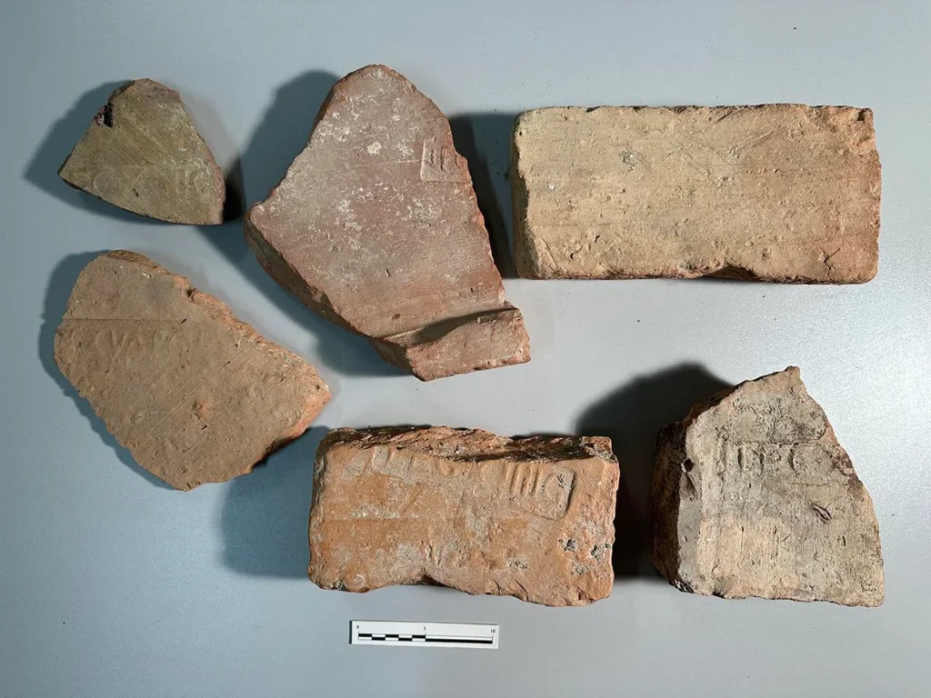
Excavations have revealed remarkably well-preserved wall sections, some reaching heights of 2.65 meters. Artifacts unearthed at the site include stamped bricks from Legio XIV and Legio XV Apollinaris—legions known to have been stationed at the nearby stronghold of Carnuntum—alongside coins, ceramics, and bronze objects. These findings underscore the military importance of the region and provide fresh insights into the Roman military system’s northern defenses.
The discovery of the Stopfenreuth bridge fort not only alters our understanding of Roman presence north of the Danube but also highlights the strategic significance of Carnuntum, which served as the capital of the Roman province Pannonia Superior.
📣 Our WhatsApp channel is now LIVE! Stay up-to-date with the latest news and updates, just click here to follow us on WhatsApp and never miss a thing!!
Archaeologist Christian Gugl noted, “For a long time, it remained uncertain whether there had ever been a substantial Roman presence on this section of the north bank of the Danube. The discovery of additional stone forts—some evidently garrisoned by large military units—significantly reshapes our perception of the Roman Limes.”
Beyond its historical implications, the excavation contributes to environmental and geological research. Collaborating with BOKU University and the University of Vienna, archaeologists collected sediment samples from the Danube floodplain, aiding scientists in reconstructing ancient river patterns prior to the 16th century. This research offers a clearer understanding of how the Danube evolved over the centuries and how these changes influenced settlement and fortification strategies.
As the excavation phase concludes, the ongoing scientific research promises to unveil even more about the Roman Empire’s legacy in Austria, enriching our understanding of its military, economic, and environmental history.
The Stopfenreuth bridgehead fort stands as a testament to the enduring impact of Roman engineering and strategy, inviting further exploration into the depths of Austria’s ancient past.
Austrian Archaeological Institute (ÖAI)
Cover Image Credit: Aerial view of the excavation in the Hainburger Au (near Stopfenreuth) on one of the Danube tributaries in the Donauauen National Park. Credit: H. Wraunek, Province of Lower Austria