8 December 2025 The Future is the Product of the Past

Native American artifacts from 1100 AD found in North America’s First City

Cahokia is the largest and most significant urban settlement of the Mississippian culture, known for creating massive earthen platform mounds throughout the southeast, east, and Midwest of the United States approximately 500 years before European contact.

These were not the Mexican Maya or Aztec people. About 700 A.D., this culture emerged in the Mississippi Valley, in what is now Illinois, and it vanished roughly a century before Columbus arrived in America. The ancient civilization’s massive remains stand as one of the best-kept archaeological secrets in the country.

Without a doubt, Cahokia was one of North America’s most sophisticated societies. Nevertheless, a lot remains to be discovered about its mysterious past, especially about its fall, which has been the subject of continuous discussion. This pre-Columbian city had 20,000 residents spread over six square miles at its height, receiving the moniker “City of the Sun.”

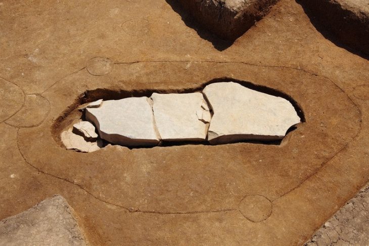
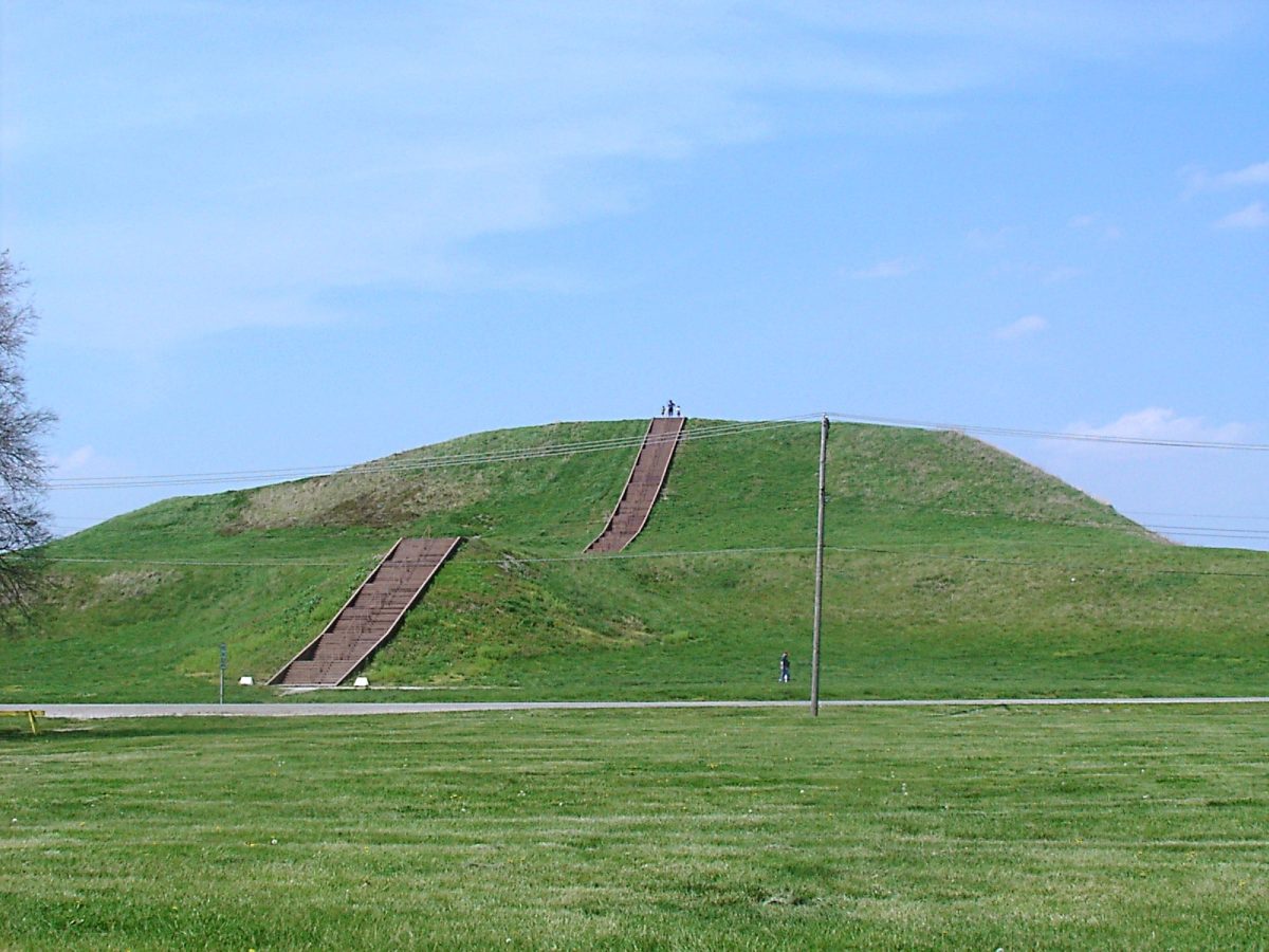
With 120 earthen mounds, Cahokia was the largest city ever built north of Mexico prior to the arrival of Columbus. Numerous of them were massive pyramids with square bottoms and flat tops that served as enormous pedestals for the residence of civic leaders. The largest earthwork in the Americas, the 100-foot Monk Mound, rose at the large plaza in the city’s center.

No one knows the Cahokians’ ethnicity, language, songs, or even what they called themselves. The name “Cahokia” is a misnomer. Cahokia was multi-ethnic, metropolitan, and connected to numerous distant societies through trade and exchange. Now, Cahokia is a UNESCO World Heritage site managed by the Illinois Department of Natural Resources.


📣 Our WhatsApp channel is now LIVE! Stay up-to-date with the latest news and updates, just click here to follow us on WhatsApp and never miss a thing!!


Artists' conception of the Mississippian culture Cahokia Mounds Site in Illinois. The illustration shows the large Monks Mound at the center of the site with the Grand Plaza to its south. This central precinct is encircled by a palisade. Three other plazas surround Monks Mound to the west, north and east. To the west of the western plaza is the Woodhenge circle of cedar posts.
Artists’ conception of the Mississippian culture Cahokia Mounds Site in Illinois. The illustration shows the large Monks Mound at the center of the site with the Grand Plaza to its south. This central precinct is encircled by a palisade. Three other plazas surround Monks Mound to the west, north and east. To the west of the western plaza is the Woodhenge circle of cedar posts.

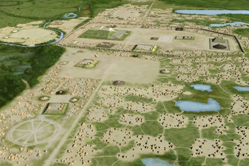
Archaeologists and students from Saint Louis University (SLU) have recently conducted a series of excavations on the western periphery of the Cahokia Mounds and made some surprising discoveries.

“I’m not interested in destroying features, just documenting them,” said Mary Vermilion, associate professor of anthropology and archaeology at Saint Louis University.

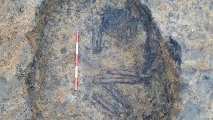
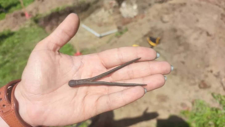
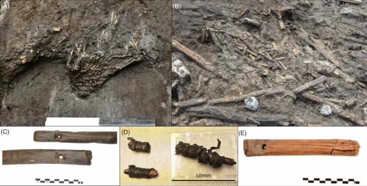
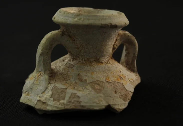
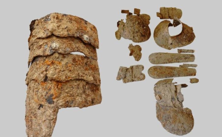
Amidst the Sterling Phase of the Mississippian Period, approximately AD 1100–1200, the team discovered wall trenches, microdrills, ceramics, and structures that date back 900 years. According to the archaeologists, the discoveries shed new light on a critical period in the chiefdom’s history, coinciding with Cahokia’s rapid population growth.

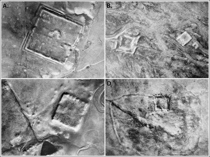
To find out if there are any more mounds or archaeological features within the acres of dense forests and marshy land close to the site’s main complex, St. Louis University and the National Geospatial-Intelligence Agency conducted an aerial survey using Unmanned Aerial Systems (UAS) and Light Detection and Ranging (LiDAR).

Researchers from St. Louis University and the National Geospatial-Intelligence Agency will soon embark on an ambitious project to create the most comprehensive and reliable 3D map of the Cahokia Mounds. This endeavor aims to provide a detailed and accurate representation of the famed prehistoric site, which will serve as a valuable resource for future studies and research.

LiDAR, a remote sensing method that uses laser light to measure distances, will enable the team to identify and map previously undocumented portions of the 2,200-acre National Historical Landmark with unprecedented precision.

Cover Photo: Monks Mound

Related Articles

Archaeologists Uncover the Second-Largest Roman Olive Oil Mill in the Empire During Major Tunisian Excavation

19 November 2025

19 November 2025

A groundbreaking archaeological mission in Tunisia has revealed one of the most significant Roman industrial sites ever uncovered: the second-largest...

During the demolition work, a 2,500-year-old bull heads alto relievo was discovered in Sinop

20 April 2022

20 April 2022

During the demolition work of the buildings in front of the historical city walls for the City Square National Garden...

White grape pips found in the Negev dated may be the oldest of its kind worldwide

29 April 2023

29 April 2023

Researchers from the University of York, Tel Aviv University, and the University of Copenhagen provide new insight into the mystery...

Experts say that the Stone of Destiny was a doorstep

2 May 2024

2 May 2024

The Stone of Destiny’s recorded links to Scottish royalty date back almost 1000 years, and its origins are shrouded in...

Hagia Sophia’s Mysterious Underground Tunnels, Vaults, Tombs to Open for Visitors

7 January 2025

7 January 2025

The Turkish Ministry of Culture is carrying out a cleaning program aimed at opening to the public the underground spaces...

700-Year-Old Church Becomes a Museum

31 January 2021

31 January 2021

It was learned that the 7-century-old church in Akçaabat, Trabzon will serve as a museum from now on. St. The...

9th-Century Slave-Built Large-Scale Agricultural System Discovered in Southern Iraq

3 June 2025

3 June 2025

A recent archaeological study has unveiled compelling evidence of a vast agricultural infrastructure in southern Iraq, believed to have been...

16th-Century Compass Possibly Belonging to Nicolaus Copernicus Unearthed in Poland’s Frombork

8 August 2024

8 August 2024

Researchers have discovered a 16th-century compass that is thought to have been used by astronomer Nicolaus Copernicus in the canonical...

Archaeologists Discover Kazakhstan’s Earliest Human Burial — A 7,000-Year-Old Neolithic Grave at Koken

24 October 2025

24 October 2025

Archaeologists in eastern Kazakhstan have uncovered the country’s oldest known human burial, dating back around 7,000 years. Found beneath Bronze...

Exploring the life story of a high-status woman from isotope data in Hungary’s largest Bronze Age cemetery

29 July 2021

29 July 2021

Researchers examined 29 tombs from Szigetszentmiklós-Ürgehegy, one of Hungary’s largest Middle Bronze Age cemeteries, and one of them, a high-status...

Syria uncovered a large intact mosaic that dates back to the Roman era

12 October 2022

12 October 2022

Syria uncovered a large intact mosaic that dates back to the Roman era, in the central town of Rastan, describing...

Gold jewelry from the time of Nefertiti found in Bronze Age tombs in Cyprus

1 December 2021

1 December 2021

Archaeologists from the University of Gothenburg have concluded an excavation of two tombs in the Bronze Age city of Hala...

11,000-Year-Old Settlement Unearthed: Saudi Arabia Reveals Oldest Human Settlement in Arabian Peninsula

27 September 2025

27 September 2025

The Saudi Heritage Commission has announced, in partnership with Japanese scholars from Kanazawa University, the discovery of the oldest known...

The Bronze Sacred Sanxingdui Tree Number 3 is Being Restored

9 April 2021

9 April 2021

According to the announcement of the Sanxingdui Museum, archaeologists have begun to assemble and restore the No. 3 bronze sacred...

Unearthing One of the Earliest Examples of Roman Monumental Architecture: Ancient Basin Discovered in Gabii

21 October 2025

21 October 2025

Hidden beneath the soil of an ancient city just east of Rome, archaeologists from the University of Missouri have uncovered...