

Scientists investigating the boat-shaped Durupınar Formation in eastern Türkiye have detected right-angled anomalies beneath the ground and unusually high carbon levels in soil collected from inside the formation, adding a new chapter to one of archaeology’s most persistent and controversial searches: the hunt for Noah’s Ark.
Researchers leading the 2026 investigation say the combination of unusual subsurface anomalies and differences in soil chemistry has opened a new line of inquiry at Durupınar. The team is now trying to determine what lies beneath the formation and whether the patterns detected by radar have a natural geological explanation—or point to something more complex.
The international project, led by archaeologist Prof. Dr. Cenker Atila of Sivas Cumhuriyet University, began fieldwork in late June near Doğubayazıt in Ağrı Province. Around 20 researchers and students from five countries are involved in a program that combines detailed mapping, three-dimensional modeling, ground-penetrating radar and laboratory analysis.
Carbon Levels Inside the Formation Are 40% Higher
One of the most striking findings so far has come from the soil samples collected across the formation.
Atila said preliminary analyses showed that carbon levels in samples taken from what the team identifies as the interior of the formation were about 40 percent higher than those measured outside it.
“The amount of carbon coming from the interior of the ship is 40 percent higher than what was found outside,” Atila said. “This raises the idea that there may be organic material or remains of wood.”
The team is now expanding the analysis dramatically. Researchers plan to collect and examine around 1,000 soil samples in an effort to determine whether the difference reflects concentrations of organic material and, more importantly, what might have produced them.
Atila said the laboratory work should yield clearer results within the next two to three months.
“The current data increase the possibility that this could be Noah’s Ark with each passing day,” he said.
The statement is notable because it comes directly from the archaeologist leading the investigation. At the same time, the carbon measurements still need to be interpreted carefully. A higher carbon concentration does not by itself demonstrate the presence of ancient timber, and researchers will need to distinguish possible archaeological material from natural organic matter in the surrounding soils.
The soil results are particularly important because they provide a second line of investigation alongside the unusual features detected beneath Durupınar by radar.
New radar scans reveal unusual geometry beneath Durupınar
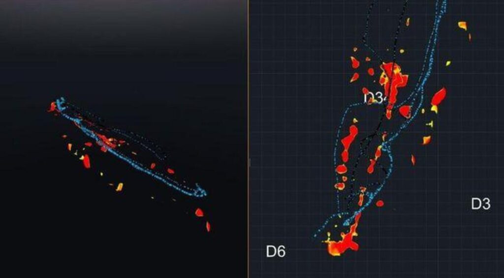
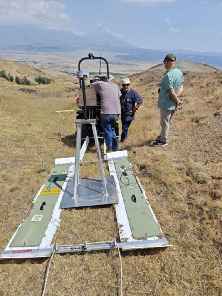
Researchers first created detailed GPS maps and digital models of the formation before carrying out a new round of ground-penetrating radar, or GPR, surveys.
According to Sivas Cumhuriyet University, the scans identified subsurface anomalies with relatively regular edges, including features that intersect at right angles. Atila said these patterns raised the possibility that cavities or structural divisions survive beneath the surface.
The radar equipment came from the United States, and the university says the technology is also used in U.S. Air Force research. That does not mean the U.S. Air Force is conducting the Durupınar investigation, as some reports have suggested. The current project remains an academic field study led from Türkiye.
Radar itself cannot identify a buried feature as wood, a wall or a ship compartment. GPR works by measuring reflections produced when electromagnetic waves encounter materials with different physical and electrical properties underground. Changes in sediment, rock, moisture, cavities and buried objects can all produce radar reflections. Archaeologists therefore need physical samples or other independent evidence before they can determine what an anomaly represents.
That distinction will become central as researchers interpret the new Durupınar data.
Soil from inside the formation contains more carbon
The second clue comes from the ground itself.
Atila said preliminary testing found around 40 percent more carbon in samples taken from what the team defines as the interior of the formation than in samples collected outside it.
Researchers are now assembling a much larger dataset of roughly 1,000 soil samples. They hope laboratory analysis can establish whether the increased carbon comes from ordinary environmental processes or from concentrations of organic material—including, potentially, degraded wood.
The carbon result should not be confused with radiocarbon dating. A higher concentration of carbon does not by itself reveal the age of a sample, nor does it demonstrate that timber once stood at the site.
Still, it is not the first time soil chemistry has attracted attention at Durupınar. The Noah’s Ark Scans research program says separate tests carried out in 2024 found substantially more organic material in samples from inside the formation than outside it. Those earlier results form part of the project’s working evidence, but they have not settled the origin of the formation.
Why has a geological formation been linked to Noah’s Ark for decades?
The Durupınar Formation has attracted speculation since Turkish army mapping officer İlhan Durupınar identified its striking outline in aerial photographs in 1959.
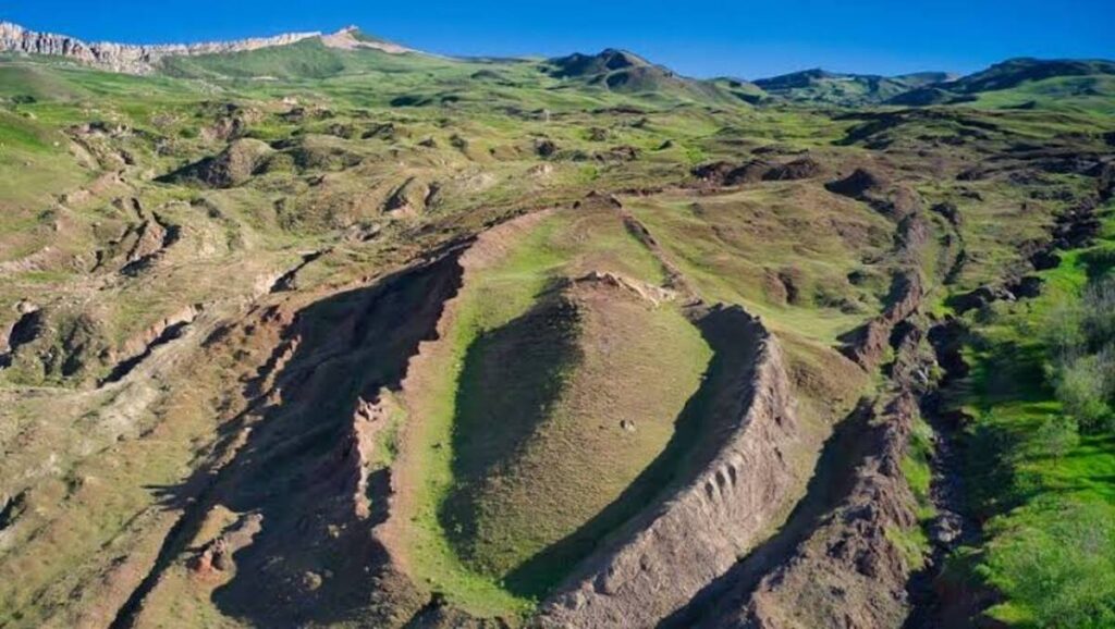
Seen from above, the feature resembles the footprint of a large vessel, with a tapered end and a long central body. It lies south of Mount Ararat in a region that has been associated with flood traditions for centuries.
Türkiye placed the formation under protection in 1987 as a cultural and natural asset, but that decision did not officially identify it as Noah’s Ark. Turkish tourism authorities continue to describe the question as unresolved and acknowledge that the feature may have formed through natural geological processes.
Its shape, however, is only part of what has kept the story alive.
The Bible gives unusually specific dimensions for the Ark
Genesis contains a remarkably detailed description of Noah’s vessel. Genesis 6 describes an ark built from a wood whose exact identification remains uncertain, divided into compartments and coated with pitch. It specifies three levels and gives its dimensions as 300 cubits long, 50 cubits wide and 30 cubits high. Using a cubit of about 45 centimeters, that corresponds to roughly 135 meters long, 23 meters wide, and 14 meters high.
This has produced one of the most repeated arguments surrounding Durupınar: its length appears broadly comparable to the biblical vessel.
But the often-repeated claim that the formation is an “exact match” needs qualification. Estimates for Durupınar vary, and different ancient cubit standards produce different measurements. Some Ark researchers use the longer Egyptian royal cubit of about 52.4 centimeters, which turns 300 cubits into approximately 157 meters—close to the length commonly cited by the Durupınar research project. Türkiye’s official tourism information gives somewhat different dimensions for the wider formation.
The dimensional resemblance is therefore intriguing, but it is not archaeological proof.
Genesis also says the Ark eventually came to rest on the “mountains of Ararat,” rather than explicitly naming the modern volcanic peak called Mount Ararat. Biblical scholarship commonly connects the Hebrew name Ararat with the ancient mountainous region of Urartu, which covered a much broader part of eastern Anatolia.
That distinction has allowed several different locations across the region to become candidates in centuries of Ark traditions.
Earlier radar surveys found similar patterns
The 2026 scans do not stand alone. Researchers conducted geophysical work at Durupınar during the 1980s, followed by newer ERT and GPR surveys in 2014, 2019 and 2021. Analysis of the 2019 radar data reported linear and angular reflections several meters beneath the surface.
A paper presented at the 7th International Mount Ararat and Noah’s Ark Symposium in 2023 described geometric patterns at depths of roughly 3 to 7 meters and compared them with signals recorded during earlier investigations in the 1980s. The authors argued that the similarities deserved additional investigation rather than treating the radar images as confirmation of a vessel.
The new campaign is significant because researchers can now return to these suspected zones with a broader grid, improved mapping and extensive sampling instead of relying on isolated scans.
But geology presents a serious competing explanation
Any new claim about Durupınar must confront a much older geological argument.
In a peer-reviewed 1996 study published in the Journal of Geoscience Education, geologist Lorence G. Collins and explorer David Fasold—who had previously supported the Ark interpretation—concluded that Durupınar was a natural geological formation.
They interpreted the structure as part of a doubly plunging syncline, a folded geological feature capable of creating an elongated, symmetrical outline through erosion. Their microscopic analysis also concluded that earlier claims of iron fittings, petrified wood and shipbuilding material could instead be explained by naturally occurring volcanic rocks and concentrations of minerals including limonite and magnetite.
That study remains one of the strongest scientific objections to identifying Durupınar with Noah’s Ark.
The question facing the 2026 team is therefore more precise than simply asking whether the formation looks like a ship. Researchers need to determine whether the new anomalies can be explained by the site’s known geology—or whether they contain materials, structures or spatial patterns that geology alone cannot easily account for.
What would researchers need to find?
Right angles and carbon-rich soil may provide targets, but physical evidence would dramatically change the discussion.
Recovering identifiable worked timber would be particularly important. Researchers would need microscopic analysis to establish that the material was genuinely wood, followed by secure radiocarbon dating and examination of its archaeological context.
Likewise, a cavity that resembles a room on a radar image would become much more significant if core drilling revealed repeated artificial layers, construction materials or structural elements in the same location.
The project’s approved research plan calls for precisely this step-by-step approach. Geophysical mapping comes first, followed by targeted soil and core sampling. Excavation would only become relevant if those less destructive methods produced evidence strong enough to justify it.
The next tests may decide whether the mystery moves forward
Atila says laboratory work on the current soil samples should produce clearer results within roughly two to three months.
The broader investigation will take longer. Sivas Cumhuriyet University originally announced that laboratory analysis would continue through the winter, with the full 2026 research program expected to generate publications and a comprehensive report during 2027.
For now, Durupınar remains what it has been for more than six decades: an extraordinary boat-shaped formation surrounded by an equally extraordinary claim.
The difference in 2026 is that researchers are no longer relying only on its silhouette.
They now have specific underground anomalies to test, hundreds of soil samples to compare, and a geological explanation that any Ark hypothesis must overcome. Whether those lines of evidence converge on an archaeological structure—or return Durupınar firmly to geology—will depend on what the laboratory and subsurface samples reveal next.
