
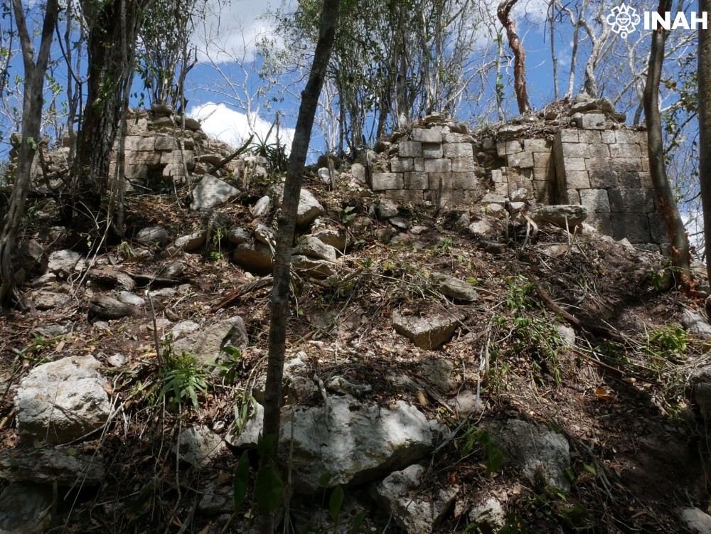
A Maya city discovered deep in the forests of southeastern Mexico just months ago is beginning to reveal its political history. Archaeologists have identified the possible original name of the settlement, a ruler named Suutz’, meaning “Bat,” and evidence of conflict with a neighboring Maya city. The findings come from newly deciphered hieroglyphs on stone monuments that survived more than a thousand years of abandonment.
The city lies in Campeche, north of the Calakmul Biosphere Reserve. In May 2026, a Mexican-Slovenian archaeological team led by Ivan Šprajc discovered the settlement and named it Minanbé, meaning “there is no road” in Yucatec Maya, after the difficult journey through the forest.
Now, epigrapher Octavio Esparza Olguín of the National Autonomous University of Mexico (UNAM) has identified inscriptions suggesting that the city’s ancient inhabitants called it Sakil, a Maya term associated with whiteness.
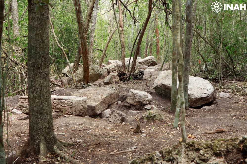
A Maya City That Archaeologists Could Barely Reach
The discovery emerged from a long-running archaeological survey of the Central Maya Lowlands. Researchers used airborne LiDAR data to identify ancient structures beneath the forest canopy before traveling to the site.
The team and local workers cleared approximately five kilometers of overgrown terrain before continuing on all-terrain vehicles and walking farther into the forest. Unlike many other archaeological sites in the region, Minanbé showed no apparent evidence of modern looting.
The settlement covers approximately 15 hectares and contains plazas, palatial and religious buildings, terraces, and water-management features. One temple pyramid rises more than 13 meters and displays architectural characteristics associated with the Río Bec style.
During their initial survey, archaeologists recorded 14 stelae and altars, several bearing carved figures and hieroglyphic inscriptions. These monuments now provide the key evidence for reconstructing the city’s history during the Late Classic period, approximately AD 600–900.
A Ruler Named Bat and the City’s Forgotten Name
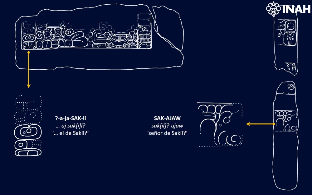
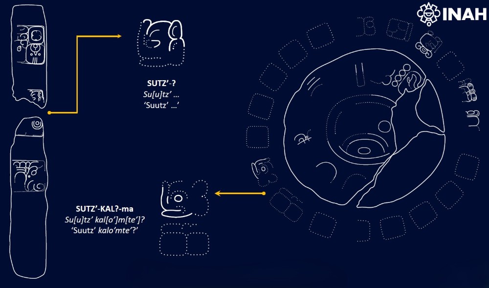
According to the Mexican National Institute of Anthropology and History (INAH), Esparza Olguín identified the name Suutz’, meaning “Bat,” on Stela 7 and Altar 6.
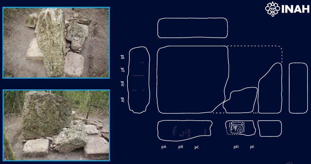
Stela 7 originally formed a larger monument that the Maya later divided into three sections. One surviving fragment depicts the ruler wearing an elaborate headdress, a pectoral, a decorated garment, and sandals.
Hieroglyphs along the monument’s left side record his name alongside a place-related title containing the signs sak and ajaw, meaning “lord.” Their arrangement resembles another inscription at Ocomtún, a Maya city approximately 40 kilometers northwest of Minanbé.
That connection led Esparza Olguín to propose Sakil as Minanbé’s ancient name.
The inscriptions also associate Suutz’ with the prestigious title kalo’mte’. During much of the Classic period, powerful rulers with regional authority used this designation, although smaller centers increasingly adopted it toward the period’s end.
The title suggests that Minanbé’s ruler claimed considerable political standing, even though his city occupied a relatively modest area.
A Captive Reveals Conflict Between Two Maya Cities
The clearest evidence of political tension comes from Ocomtún, a larger Maya center that Šprajc’s team discovered in 2023.
Archaeologists identified an inscription on Monument 1, a carved stone that originally formed part of a doorway lintel before someone reused it as a step in an architectural complex.
The relief depicts a captive lying face down, with his wrists bound and his head turned sideways. Hieroglyphs beside the figure identify the captive’s place of origin as Sakil.
By comparing this inscription with Stela 7 at Minanbé, Esparza Olguín established a possible connection between the two cities and their rulers. The evidence suggests that Minanbé and Ocomtún, whose ancient name researchers identify as Maatz’, experienced military conflict during the Late Classic period.
However, the surviving inscriptions do not yet establish the circumstances of the confrontation or its outcome.
Ancient Inscriptions Reveal a Political Landscape
Time and deliberate damage have erased much of Minanbé’s written history. Of nearly 20 monuments documented at the site, at least five preserve traces of inscriptions or carved imagery.
Researchers used photogrammetry to create detailed three-dimensional models, allowing them to examine damaged surfaces under different lighting conditions and identify characters that were difficult to distinguish in the field.
The team’s original June 2026 announcement also described a monument bearing a possible decapitation scene and a date corresponding to AD 849, near the end of the region’s Classic-period political order.
The latest readings have therefore transformed Minanbé from a recently mapped archaeological site into a settlement with a possible ancient name, an identifiable ruler, and evidence of rivalry with a neighboring city.
