
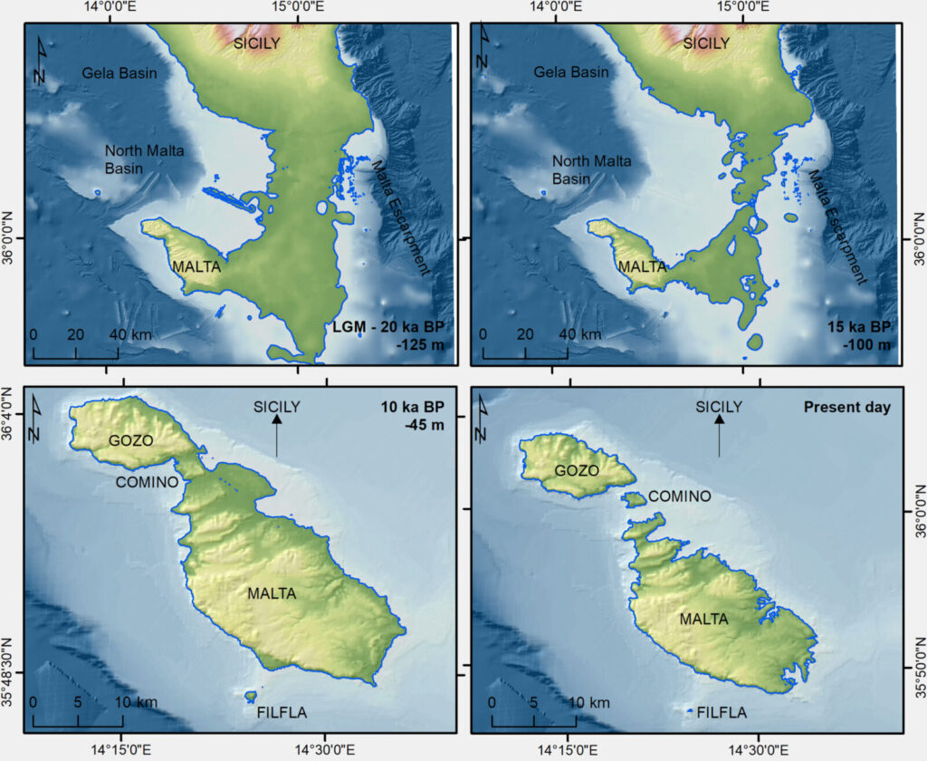
There was once a way to travel from Sicily to Malta without crossing the open sea. During the last Ice Age, a vast stretch of land connected the two, offering a possible passage for animals and perhaps prehistoric humans. Then, around 13,000 years ago, rising waters swallowed the connection, leaving a lost landscape beneath the Mediterranean.
The most surprising finding, however, is that this lost route may have looked less like a conventional land bridge and more like a scattered world of islands and sheltered waterways.
The discovery raises a compelling question: could this submerged territory preserve clues to a forgotten chapter of Malta’s human history?
A Journey That No Longer Exists
Imagine standing on the southeastern coast of Sicily thousands of years ago and looking toward what is now Malta. Instead of the more than 90 kilometres of open water that separate the islands today, the landscape would have extended across a broad area of exposed seabed.
During the last Ice Age, enormous ice sheets locked away vast quantities of water, lowering global sea levels by approximately 130 metres. As the Mediterranean retreated, land emerged between Sicily and Malta, creating a natural connection that remained largely continuous for thousands of years.
This was not necessarily an empty expanse of dry ground. The emerging picture suggests a varied coastal environment, with elevated ridges, low-lying areas, and sheltered basins. Such a landscape could have offered different habitats as the climate and coastline changed.
Animals may have moved across this connection, while prehistoric groups living in Sicily could potentially have explored its coastal areas in search of food. Whether people actually crossed all the way to Malta, however, remains an unanswered archaeological question.
The landscape itself eventually disappeared. As the last Ice Age ended, melting glaciers raised sea levels and gradually submerged the low-lying corridor. By around 13,000 years ago, the continuous land connection had vanished, leaving Sicily and Malta separated by the sea.
The Lost Land Bridge May Have Been an Ancient Archipelago
What scientists found beneath the Mediterranean was not quite the straightforward land route they had expected.
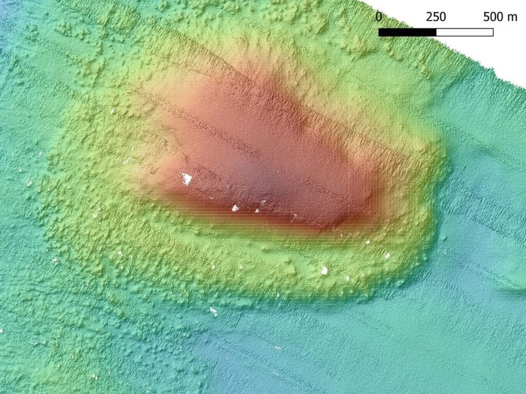
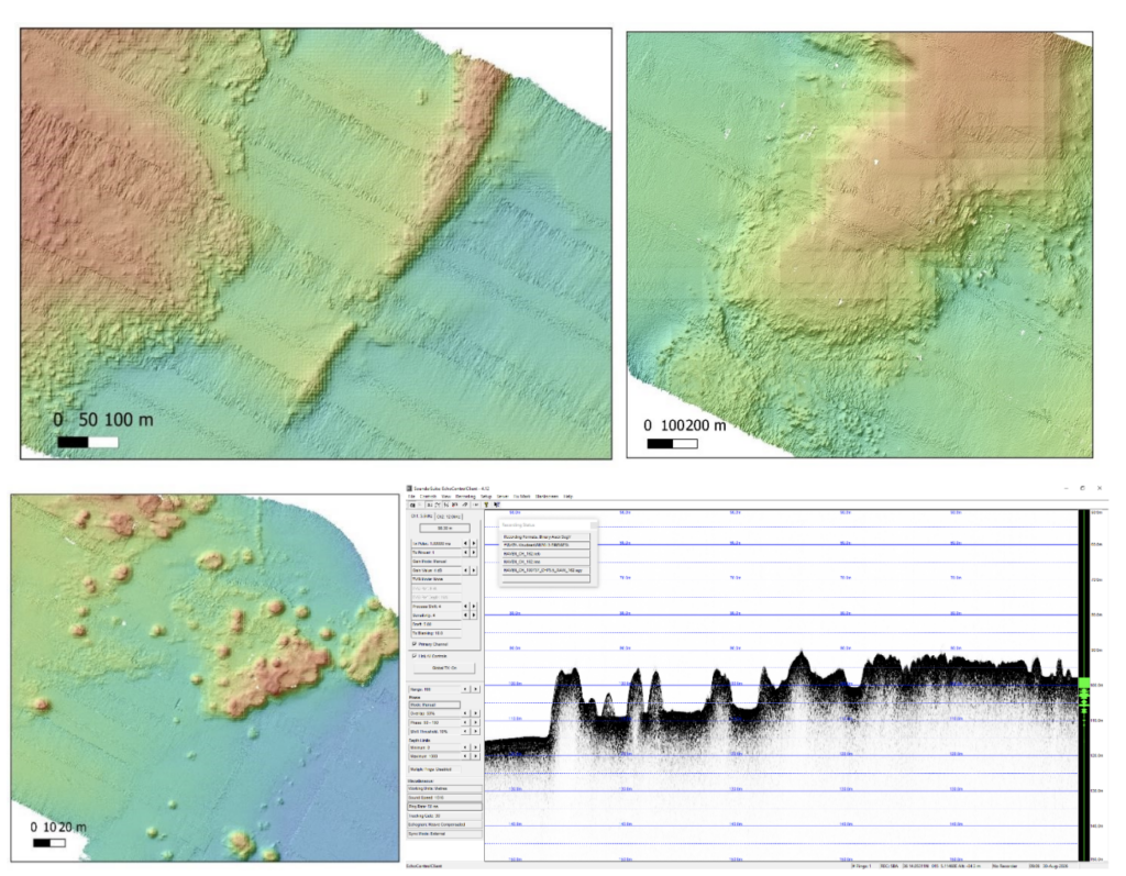
During the BRIDGES expedition, researchers aboard the Italian research vessel Gaia Blu examined the submerged terrain between Sicily and Malta. Their high-resolution maps revealed a surprisingly complex landscape, with elongated ridges, low-lying areas, and sheltered basins.
Instead of a simple, continuous corridor, the region may once have resembled a chain of islands separated by narrow waterways and shallow lagoons. Researchers describe this possibility as a lost archipelago, a landscape whose appearance changed as rising seas gradually consumed the land.
ismar.cnr.it
One particularly intriguing feature lies along the western edge of the former connection. There, scientists identified a rough underwater formation that could represent an ancient coral reef. Further investigations will be needed to establish its origin and reconstruct the full extent of the surrounding landscape.
The findings also offer a different way to imagine prehistoric life in the region. Rather than crossing an uninterrupted plain, animals and potentially humans may have encountered a changing environment of exposed ridges, sheltered waters, and increasingly isolated stretches of land.
Researchers recovered sediment samples to investigate how these environments evolved. Laboratory analyses and radiocarbon dating could help establish when particular areas disappeared beneath the sea and how the changing coastline shaped the possibilities for movement between Sicily and Malta.
Scientists Return to a World Beneath the Waves
Although scientists have known about the former land bridge for decades, existing seabed maps offered only an incomplete picture of its ancient geography. Much of the terrain remained poorly documented, even though it lies relatively close to Europe’s present-day coastline.
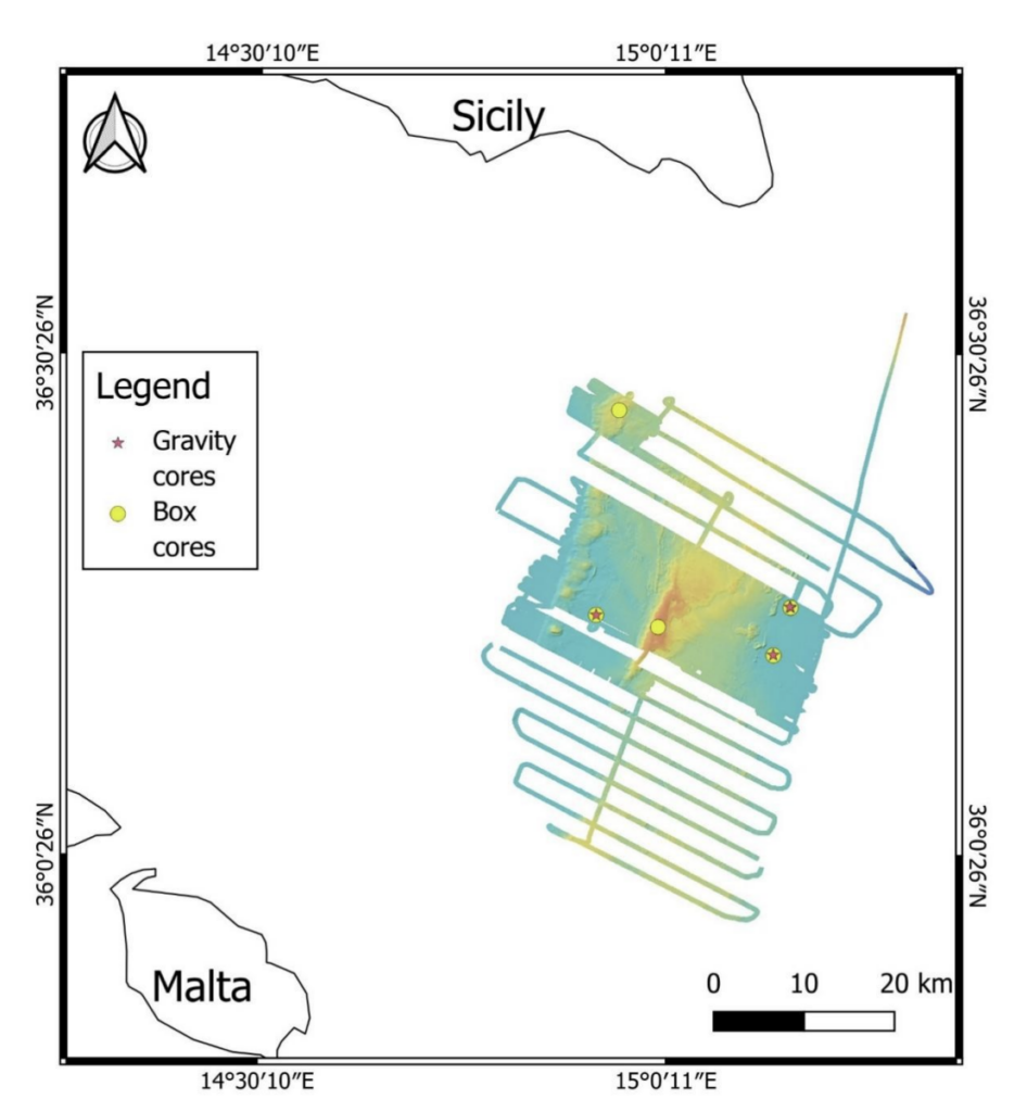
The BRIDGES expedition set out to change that. Working aboard the Italian research vessel Gaia Blu, researchers from Italy’s National Research Council (CNR), the National Institute of Oceanography and Applied Geophysics (OGS), and the University of Malta investigated the seabed between southeastern Sicily and the Maltese islands.
Their findings revealed something more complicated than a simple strip of land.
The new mapping identified discontinuous ridges extending for tens of kilometres, with depressions and former lagoons between them. Some areas resemble modern shallow coastal platforms, where natural barriers protect lagoons from the open sea.
The team also used acoustic instruments to investigate sediments beneath the seabed and recovered samples containing ancient marine deposits. Laboratory analysis and radiocarbon dating of preserved fossil fragments could help researchers establish when different environments formed and how the advancing sea changed them.
The expedition, led by Maria Filomena Loreto and Emanuele Lodolo, concluded in Catania in September 2026. Its results provide a new foundation for reconstructing the geography of a part of the Mediterranean that no longer exists above water.
Malta’s First Known Inhabitants Arrived After the Land Disappeared
The human story becomes particularly interesting when the new seabed investigation is considered alongside an earlier archaeological discovery on Malta.
For many years, archaeologists believed that the island’s first inhabitants were Neolithic farmers who arrived approximately 7,500 years ago. However, research published in Nature in April 2025 revealed that humans had reached Malta about a thousand years earlier.
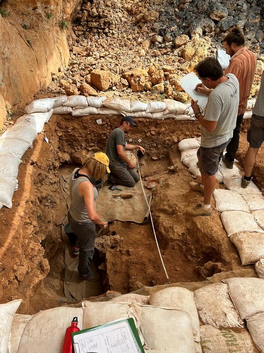
Excavations at Latnija, in northern Malta, uncovered evidence of hunter-gatherers who lived there around 8,500 years ago. They left behind stone tools, hearths, animal bones, and the remains of meals that included fish, shellfish, birds, and other wild animals.
These people had an impressive ability to exploit coastal resources. Their presence also demonstrated that hunter-gatherers could undertake substantial Mediterranean sea crossings long before the arrival of farming communities.
But there is a remarkable gap in the timeline.
By the time the Latnija inhabitants arrived, the land bridge connecting Malta to Sicily had already disappeared for approximately 4,500 years. They therefore had to reach the islands by sea, travelling roughly 100 kilometres from Sicily.
Their discovery does not establish that earlier humans used the submerged corridor. Instead, it raises the possibility that Malta’s human history may extend further back than the archaeological record currently demonstrates.
Could the Lost Land Have Been a Prehistoric Source of Food?
The ancient bridge may have been more than a potential route between two landmasses. Its varied geography suggests that it could also have provided valuable resources for people living along the changing Mediterranean coastline.
Shallow waters and sheltered lagoons can support fish, molluscs, and other marine life. If comparable environments existed along the prehistoric corridor, they might have attracted groups seeking food without requiring them to travel all the way to Malta.
This possibility is especially intriguing given the evidence from Latnija. Although its inhabitants lived much later, their remains show how extensively prehistoric hunter-gatherers could exploit Mediterranean coastal ecosystems.
Emanuele Lodolo, one of the BRIDGES expedition’s principal investigators, highlighted the archaeological importance of reconstructing these vanished environments, particularly for understanding Mesolithic and Neolithic populations, migration routes, and settlement patterns.
Scientists now hope to reconstruct the evolution of the submerged landscape more precisely. Ancient shorelines, buried valleys, and former coastal environments could help identify areas worth investigating for traces of prehistoric activity.
The researchers have not announced the discovery of human artefacts or settlements on the land bridge. For now, its connection to early migration remains a possibility rather than an established fact.
Yet the new maps reveal a landscape that could once have offered people something the Mediterranean no longer provides: a continuous stretch of land between Sicily and Malta. Whether anyone took advantage of that opportunity is a question the seabed may still help answer.
The BRIDGES Scientific Campaign – Sicily and Malta
National Institute of Oceanography and Applied Geophysics (OGS), Italy.
Scerri, E.M.L., Blinkhorn, J., Groucutt, H.S. et al. Hunter-gatherer sea voyages extended to remotest Mediterranean islands. Nature 641, 137–143 (2025). https://doi.org/10.1038/s41586-025-08780-y
Cover Image Credit: Rossi, Sofia; Prampolini, Mariacristina; Galea, Charles; Valle, Giacomo Dalla; Caruana, Albert; Soldati, Mauro (2025-02). “Geomorphological evidence of the Malta‐Sicily land‐bridge during the Last Glacial Maximum inferred from seismic profiles”. Earth Surface Processes and Landforms. 50 (2). doi:10.1002/esp.6061. ISSN 0197-9337.
