
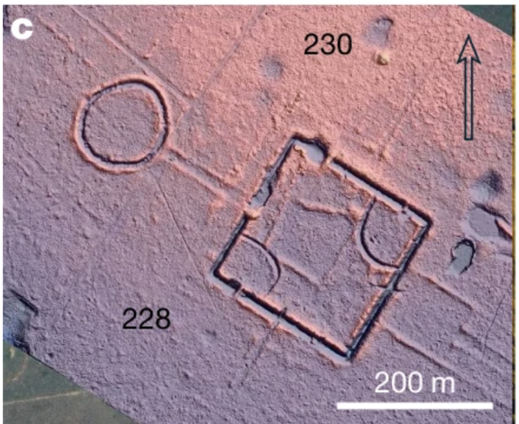
A vast network of geometric earthworks hidden beneath the rainforest suggests that southwestern Amazonia once supported a highly organized society numbering as many as three million people.
The findings, published in Nature, challenge the familiar image of the precolonial Amazon as a sparsely inhabited wilderness. Researchers estimate that the cultural landscape they call the Aquiry civilization covered approximately 183,000 square kilometres across parts of present-day Brazil, Bolivia and Peru.
During its peak between AD 100 and 300, the region may have contained between 1.25 million and three million inhabitants. Should comparable settlement densities be identified elsewhere, scientists say estimates for the entire precolonial population of Amazonia may need to be reconsidered.
Hundreds of structures detected beneath the forest
The international research team used airborne LiDAR to survey the Brazilian states of Acre and Amazonas in 2024. The technology sends laser pulses through gaps in the forest canopy, allowing researchers to construct detailed models of the ground beneath dense vegetation.
Across ten flight lines covering 4,497 square kilometres, the survey documented 432 earthworks. Only 36 had previously been identified, meaning that 396 of the structures were unknown before the LiDAR campaign.
The difference between laser mapping and conventional satellite observation was striking. In one deforested section, researchers detected 156 earthworks with LiDAR, compared with only 30 previously visible in satellite images. The results indicate that remote imagery may have underestimated the true number of structures by a factor of five.
Using these observations alongside earlier satellite surveys, the researchers calculated that the wider landscape could contain between 24,000 and 30,000 earthworks. Around two-thirds are thought to belong to the Aquiry period, although the estimate is an extrapolation rather than a direct count of every monument.
Monumental geometry in the rainforest
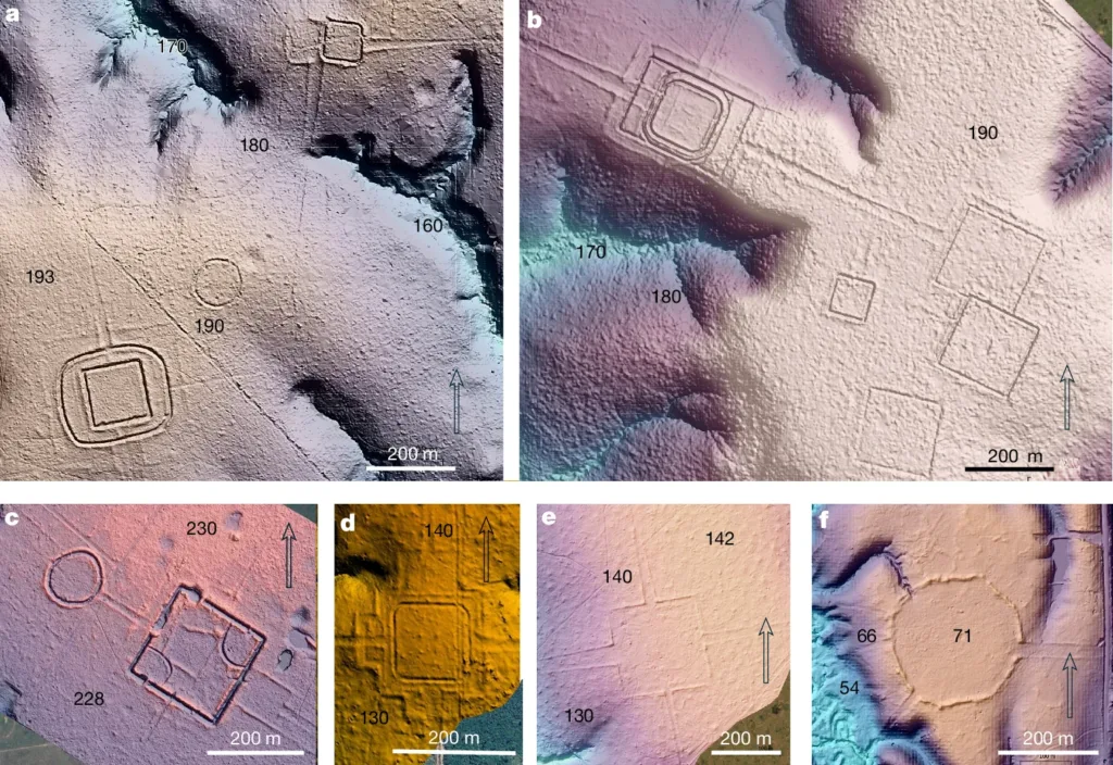
The structures were built between approximately 600 BC and AD 850. They include deep ditches, raised embankments, enclosed spaces and roads arranged in circles, squares and more complex geometric forms.
Most geoglyphs cover between 0.35 and 14 hectares, while the largest known example approaches 50 hectares. Some of the surrounding ditches measure between nine and 13 metres across and reach depths of up to five metres.
Individual enclosures were sometimes connected to roads or combined into groups containing as many as eight monuments. LiDAR also revealed previously unseen outer embankments surrounding several already known geoglyphs.
Despite their scale, the sites do not appear to have been military fortifications. Researchers found no clear defensive features and little evidence that people lived permanently inside the enclosures.
Instead, the monuments probably functioned as public, political and ceremonial centres where communities from the surrounding landscape assembled periodically. Their role may have resembled gathering centres later used in parts of the Inca world, where different groups met for ceremonies, political events and communal activities.
Constructing and maintaining these enormous forms over roughly 1,500 years would have required organized labour, administrative coordination and a sophisticated understanding of geometry. The researchers suggest that the gatherings may have involved ritual performances, music, dance, sport and political negotiation.
A population larger than previously imagined
Earlier studies proposed that only about 60,000 people had occupied the geoglyph region. That estimate was based on a time when only around 200 earthworks were known.
The new study raises the estimated number of Aquiry-period monuments to approximately 16,660. Researchers calculate that between 25 and 60 percent of them may have been active simultaneously during the civilization’s peak.
Assuming that an average community of roughly 300 people constructed and maintained each centre, the total population would have reached between 1.25 million and three million. The researchers acknowledge that the calculation depends on several assumptions, but evidence from later mound villages and Indigenous ceremonial gatherings supports the proposed community size.
Within the 85,000-square-kilometre core area, population density may have reached between 13.6 and 32.6 people per square kilometre—far higher than traditionally expected for the interior Amazon rainforest.
The forest bears traces of its former inhabitants
The Aquiry communities did more than construct monuments. Archaeological evidence indicates that they actively shaped the forest around them.
They cultivated maize, squash, manioc, sweet potatoes, beans, peanuts and chilli peppers. Brazil nut trees and several edible palm species remain especially common near archaeological sites, suggesting that their modern distribution partly reflects centuries of human planting and management.
The study also proposes that repeated burning of bamboo-rich areas may have helped maintain fertile soils, creating conditions in which large and complex communities could develop.
Rather than adapting passively to an untouched rainforest, the inhabitants managed water sources, agricultural plots and forest gardens. Their legacy may still be visible in the composition of today’s vegetation, soil fertility and biodiversity.
This wider environmental impact gives the discovery significance beyond archaeology. The authors argue that future studies of Amazonian biodiversity, sustainable land use and even climate modelling should account for thousands of years of human intervention.
The reason the monumental geoglyph tradition ended around the ninth century remains unknown. Later communities built mound villages in parts of the same region, indicating cultural transformation rather than the complete disappearance of human settlement.
For now, the study reveals only a fraction of what may remain beneath the canopy. If similarly dense archaeological landscapes are detected elsewhere, long-standing estimates of the Amazon’s population before European colonization—and the scale of its influence on the rainforest—may have to be rewritten.
Pärssinen, M., Kalliola, R., Ranzi, A. et al. Over 20,000 precolonial earthworks in the Southwest Amazonia. Nature (2026). https://doi.org/10.1038/s41586-026-10835-7
