

A newly discovered Inca road near Machu Picchu may have been built as a ritual route toward a sacred mountain, according to the archaeologist overseeing research at the famous Peruvian site.
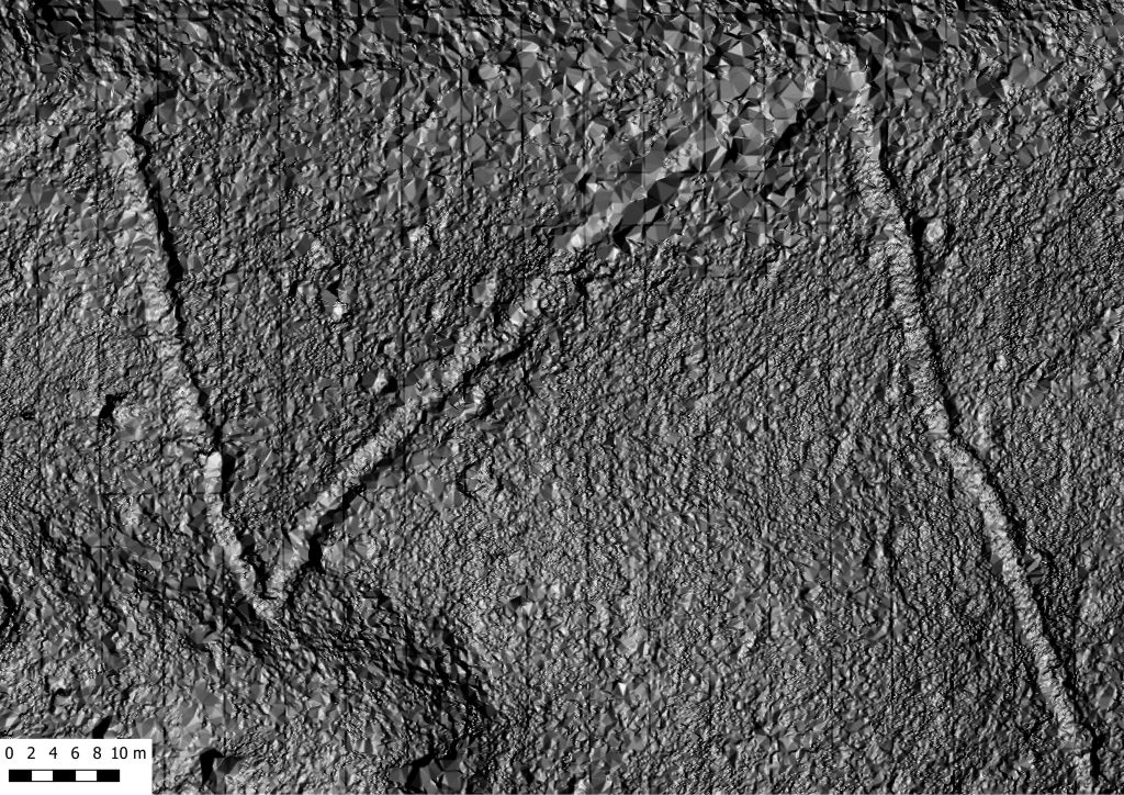
The route is part of a previously unknown network of more than 2.5 kilometers (1.6 miles) of pre-Hispanic roads detected beneath dense tropical vegetation around the so-called Mandor Wall, east of Machu Picchu. Researchers identified the features using LiDAR, a remote-sensing technology capable of mapping terrain through heavy forest cover.
Now, new observations are raising a more intriguing question: the structure traditionally described as a defensive “wall” may instead include an elevated ceremonial road aligned toward Yanantin, a mountain rising about 4,100 meters above sea level.
Nino del Solar Velarde, head of archaeological research coordination at Machu Picchu for the Cusco Directorate of Culture, told Peru’s Andina news agency that the direction of the route suggests a possible ritual purpose.
Rather than treating that interpretation as settled, archaeologists are preparing field investigations that could determine whether the road really belonged to a ceremonial landscape surrounding Machu Picchu.
A road invisible beneath the forest
The discovery emerged from archaeological reconnaissance conducted in July 2026 through cooperation between Peru’s Directorate of Culture in Cusco and the University of Warsaw’s Center for Andean Studies.
LiDAR surveys revealed more than 2.5 kilometers of previously undocumented roads, together with possible platforms and terraces around Mandor. One principal route can already be traced for at least 1.2 kilometers.
Its zigzagging course and other architectural characteristics are consistent with construction techniques used during the Inca period, although Peru’s Ministry of Culture has stressed that excavation and further archaeological work are still required to establish its precise chronology and function.
The University of Warsaw, whose researchers participated directly in the project, describes the features more specifically as previously unknown roads dating to the Inca period. The university said the roads had remained effectively invisible because they were covered by dense tropical forest on the opposite side of the Urubamba Valley from Machu Picchu.
This is precisely the kind of landscape in which LiDAR has transformed archaeological survey. Laser pulses collected from the air can be processed to reduce the visual obstruction caused by trees and vegetation, exposing subtle changes in topography that may represent roads, terraces, walls or buildings.
Was the ‘Mandor Wall’ really a ritual road?
The most significant new interpretation concerns the Muralla de Mandor, or Mandor Wall. Sections of the structure reach between two and three meters in height. Its appearance had encouraged the idea that it might have served as a barrier, perhaps defining or protecting part of the territory around Machu Picchu.
Del Solar says the archaeological evidence identified so far does not point clearly to a conflict that would explain the construction of a defensive wall. Instead, the route follows the natural geography of the mountain. According to Del Solar, its alignment points toward Yanantin, one of the peaks incorporated into the sacred landscape surrounding Machu Picchu.
That raises another possibility: at least part of what has been called a wall could have functioned as a raised ritual road.
“The direction goes toward an elevated peak” on the same axis as Yanantin, Del Solar told Andina, an alignment that leads researchers to consider a ceremonial interpretation.
In Andean cosmology, mountains were not simply landmarks. Prominent peaks could be understood as sacred entities, or apus, embedded in relationships involving communities, water, fertility, protection and the surrounding landscape.
Machu Picchu itself sits within an extraordinary mountainous setting dominated by peaks including Putucusi, Pumasillo and Salkantay. If the Mandor route was deliberately oriented toward Yanantin, its position may help archaeologists understand how movement through this landscape carried religious as well as practical meaning.
Machu Picchu extended far beyond the stone city
The discovery also reinforces a broader change in how archaeologists view Machu Picchu. The famous stone settlement was not an isolated complex surrounded by wilderness. Roads linked it with terraces, satellite settlements, agricultural zones and other places distributed across the mountainous terrain.
Del Solar estimates that the wider landscape includes more than 300 kilometers of roads connecting Machu Picchu with associated sites. The newly identified Mandor route appears to continue south and may eventually connect with archaeological structures that researchers had already documented elsewhere in the area.
LiDAR data have also revealed possible circular structures and additional platforms. Some archaeological features in the Mandor zone were known from earlier work, but the new high-resolution survey has allowed researchers to trace relationships between them that were extremely difficult to recognize from ground level.
This distinction is important. Archaeologists have previously used LiDAR around Machu Picchu, including in the Mandor landscape. The 2026 work is significant because it has now exposed a much more extensive road system and provided targets for direct archaeological investigation. Earlier research had already demonstrated the technology’s ability to reveal structures obscured by vegetation in this part of the archaeological park.
Archaeologists will now go beneath the LiDAR map
For the moment, the evidence comes primarily from remote sensing and archaeological reconnaissance rather than excavation.
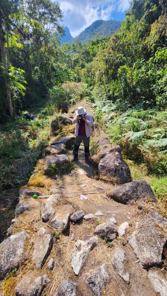
Researchers expect to carry out physical surveys of the identified roads beginning toward the end of 2026 and into early 2027. Those investigations should help establish how the routes were constructed, when they were used, and whether the proposed connection with ritual activity can be supported by material evidence.
The precise locations are also being treated cautiously. University of Warsaw archaeologist Mariusz Ziółkowski said researchers are withholding detailed location information because of concerns about damage by amateur treasure hunters.
Peru’s Ministry of Culture has already announced support for continuing archaeological research in the Mandor area.
For now, the LiDAR data have changed one part of the map around Machu Picchu. The next stage may determine something more consequential: whether a road concealed by the forest was designed not simply to move people across the mountains, but to lead them toward a place the Inca regarded as sacred.
