
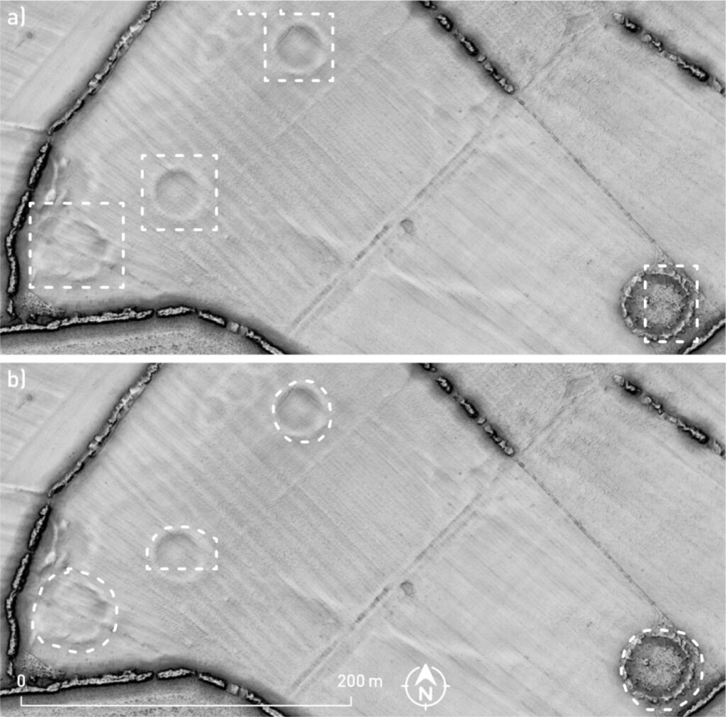
A new tool called ADAF scans airborne laser-scanning data to flag archaeological features that even trained analysts can overlook.
Archaeologists are increasingly turning to artificial intelligence to examine landscapes for traces of the past. A study published in the Journal of Archaeological Science: Reports in May 2026 introduces ADAF, a deep-learning tool designed to detect archaeological features in airborne laser-scanning data.
Researchers from the Research Centre of the Slovenian Academy of Sciences and Arts (ZRC SAZU), the Discovery Programme in Ireland, and partner institutions including Bias Variance Labs developed ADAF to automate part of the process of identifying archaeological features in large landscape datasets.
In a practical test in Ireland, the system achieved an 84% recall rate for known archaeological sites and flagged 116 potential sites that had gone unnoticed in earlier manual surveys, according to the researchers.
The significance of the study lies less in demonstrating that AI can process large datasets — that capability is already well established — and more in showing how ADAF applies it to a specific archaeological problem. By automatically screening LiDAR data for features such as enclosures, ringforts, and barrows, the tool gives archaeologists another way to identify areas that warrant closer investigation.
How ADAF works
ADAF stands for Automatic Detection of Archaeological Features. It analyzes airborne laser-scanning (ALS) data, commonly known as LiDAR data, which captures detailed information about the shape and elevation of the ground and turns it into digital models of a landscape.
Ancient structures don’t always survive as obvious ruins. Some leave only subtle traces — a shallow depression, a low mound, the faint outline of an enclosure — that are easy to miss during conventional surveys, especially across large areas.
ADAF uses deep-learning models to search ALS-derived data for patterns associated with archaeological features. Two components sit at its core: the Relief Visualisation Toolbox (RVT), which processes ALS data into visualisations suitable for machine-learning analysis, and the Artificial Intelligence Toolbox for Earth Observation (AiTLAS), which provides the underlying detection models; an HRNet network for semantic segmentation and a Faster R-CNN network for detecting individual features. Both toolkits are established tools that have been applied in aerial archaeology.
Researchers trained the system on an extensive archive of ALS data from Ireland, which experts labelled across three categories of archaeological features: enclosures, ringforts, and barrows. To build the training set, they digitised segmentation polygons for more than 10,700 recorded monuments and processed over 200 individual ALS datasets.

The developers also designed the tool with a simple interface, allowing archaeologists to use it without a background in machine learning.
Testing ADAF
ADAF grew out of a practical need. Transport Infrastructure Ireland (TII), which funded the project through its Open Research Call, needed a faster way to flag unknown or potentially significant monuments early in road-scheme planning; work too large in scale for manual survey or the private sector to handle within the programme’s constraints. The Discovery Programme led the project in partnership with ZRC SAZU and Bias Variance Labs to meet that need.
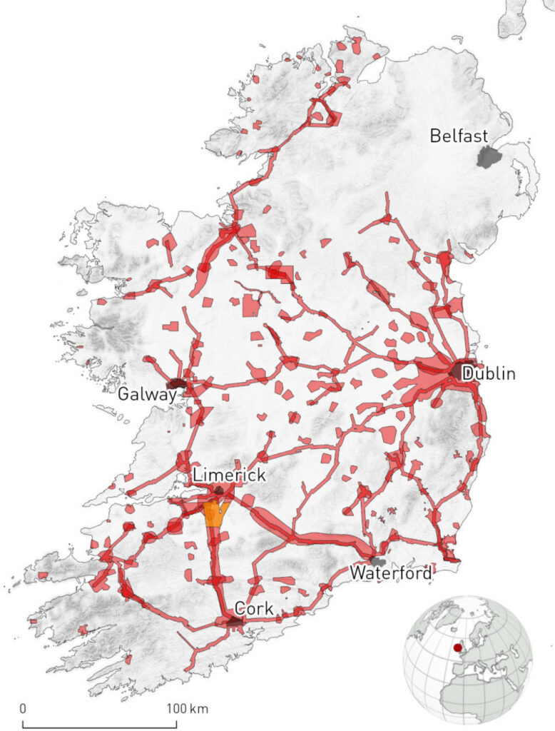
The researchers tested ADAF along an active TII infrastructure-development corridor in Ireland, comparing its output with archaeological information that human analysts had previously identified.
The AI achieved an 84% recall rate for known archaeological sites in the test area. More notably, it identified 116 potential archaeological sites that manual visual inspection had missed.
That number doesn’t mean 116 confirmed archaeological sites were discovered. The researchers describe them as potential new sites; each one still needs archaeological assessment to confirm whether the feature is genuinely archaeological and, if so, what it represents.
Why LiDAR matters
Airborne laser scanning has become a key tool in landscape archaeology because it lets researchers examine large areas in fine detail.
It’s especially useful where vegetation, modern land use, or other factors make archaeological remains hard to spot from the ground.
A single LiDAR survey can generate an enormous amount of information. Archaeologists can review the data manually, but doing so across large landscapes takes considerable time and increases the risk of overlooking subtle features.
The researchers behind ADAF point to another limit of manual interpretation: results can shift depending on an analyst’s experience, expectations, and observational skills.
Machine learning offers a more systematic way to work through these large datasets. The logic is straightforward: repetitive manual work at a scale that’s hard for people to handle efficiently is a natural candidate for automation.
A tool that can be adapted beyond Ireland
The researchers developed ADAF using Irish archaeological data and trained it to recognize a specific set of monument types. However, they say researchers can retrain the underlying models on data from other regions and to identify other kinds of archaeological features.
Archaeologists elsewhere increasingly have access to their own airborne laser-scanning datasets, but analyzing them at scale remains the bottleneck. A tool that can automatically screen those datasets could make large-scale survey more practical, particularly for features that are difficult to spot through conventional inspection.
The team has made ADAF’s source code openly available on GitHub under an Apache 2.0 license and archived the trained models used in the study on Zenodo. They describe this openness as a deliberate step toward making machine learning as accessible to archaeologists as GIS software became in the 1990s: once a specialist tool, now a standard part of the field.
Čož, N., Corns, A., Curran, S., Kocev, D., & Kokalj, Ž. (2026). Automatic detection of archaeological features from airborne laser scanning data using deep learning: Development and evaluation of the ADAF tool. Journal of Archaeological Science: Reports, 71, 105733. Published online March 31, 2026; published May 2026.
