
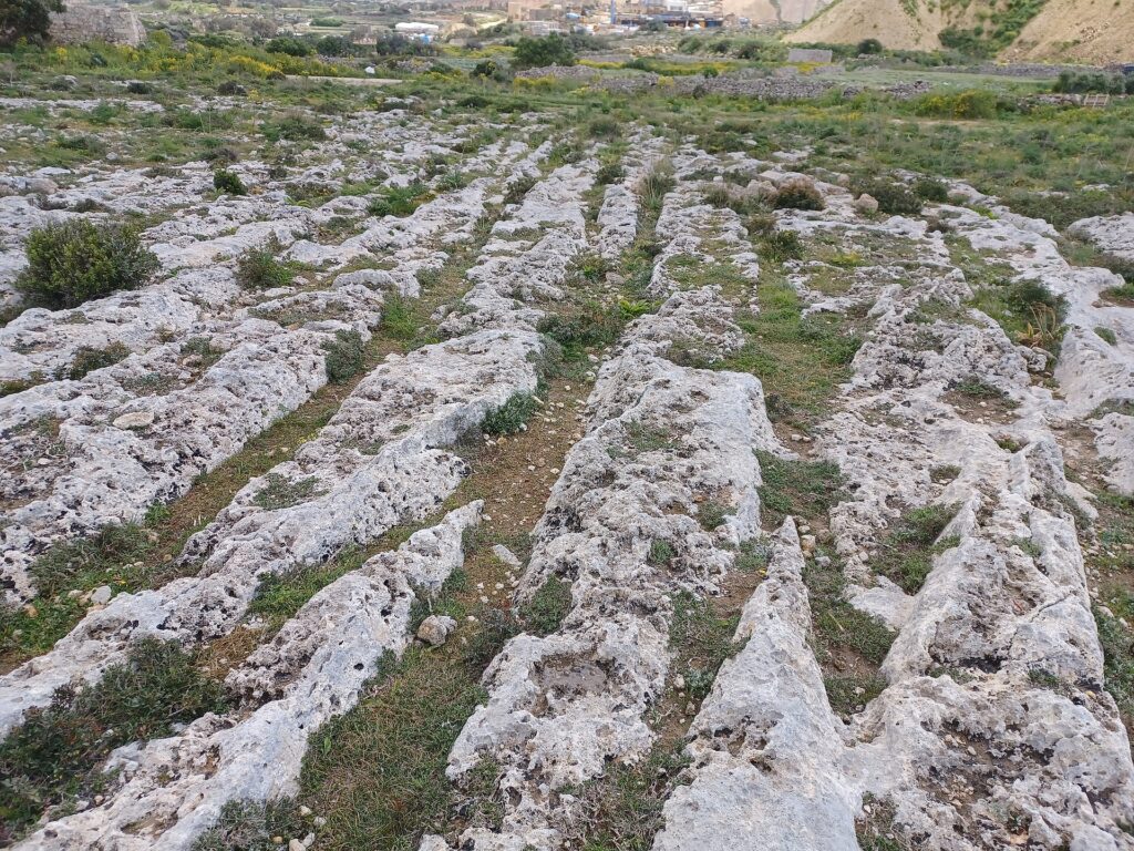
For centuries, mysterious parallel grooves running across Malta’s limestone landscape have puzzled archaeologists and visitors alike. Often associated with the island’s prehistoric inhabitants, these unusual tracks may have a very different history. A major new study examining 2,628 ancient routes suggests that much of this extensive network developed during the Phoenician, Punic, and Roman periods rather than thousands of years earlier. The findings challenge longstanding assumptions about one of the Mediterranean’s most enigmatic archaeological features.
Across Malta and Gozo, deep parallel grooves cross exposed limestone hills, intersect at unusual angles, and sometimes disappear beneath fields or into the sea. Known as cart ruts, these formations have inspired explanations ranging from prehistoric transportation systems to deliberately engineered routes for moving enormous stone blocks. Despite centuries of investigation, their precise age and original purpose have remained subjects of debate.
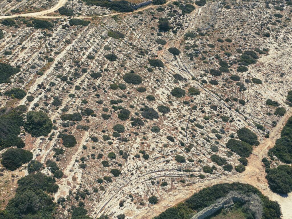
The most famous concentration lies at Misraħ Għar il-Kbir, popularly called Clapham Junction because its overlapping tracks resemble a complicated railway network. Now, archaeologist Joel Grima of the University of Malta has undertaken the most extensive assessment of these formations to date. His research, published in the Journal of Archaeological Science: Reports, combines digital surveying, archaeological excavations, historical records, and statistical analysis to reconsider their origins.
More Than 2,600 Ancient Routes Across Malta
Grima assembled the largest dataset of Maltese cart ruts yet compiled, identifying 2,628 distinct tracks extending approximately 49.65 kilometers. The research examined 228 archaeological sites, including 155 documented through three-dimensional models created from drone and ground photography. Another 82 historically recorded locations have since been destroyed or become inaccessible, bringing the total number of known sites across Malta and Gozo to 310.
The scale of the survey allowed the researcher to examine connections that earlier studies could only investigate at individual locations. Some grooves follow relatively straightforward routes, while others diverge, overlap, or cross one another in dense concentrations. At Misraħ Għar il-Kbir, an area measuring just 80 by 100 meters contains an exceptionally complicated arrangement of intersecting tracks.
For decades, researchers have debated whether these formations originated during Malta’s prehistoric temple-building cultures, the Bronze Age, or later historical periods. Their weathered appearance and occasional proximity to megalithic monuments encouraged early interpretations favoring considerable antiquity. However, Grima found no reliable archaeological evidence conclusively dating any individual pair of ancient cart ruts to prehistoric times.
Instead, the strongest dating evidence links a substantial proportion of the network to Malta’s Classical period, encompassing the Phoenician, Punic, Roman, and Byzantine eras.
Roman Roads Offer Important Dating Evidence
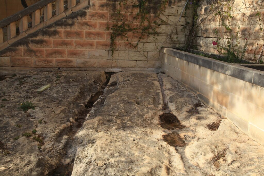
One of the most revealing examples comes from the ancient city of Melite, near modern Mdina and Rabat. At the Domus Romana archaeological site, a pair of cart ruts survives within a street bordered by Roman buildings. Excavations documented multiple Roman road surfaces above the original exposed limestone, indicating that the grooves formed before later phases of road construction.
The evidence places these tracks within an established urban transportation network, although their precise initial date remains uncertain. Grima considers them unlikely to predate the Phoenician or Punic development of the city. Their relationship with Roman architecture nevertheless provides considerably stronger chronological evidence than the appearance of the grooves alone.
Another important example comes from il-Qortin in Marsa, where an eighteenth-century historical record documented substantial Roman warehouse buildings beside the Grand Harbour. Cart tracks apparently connected the complex with nearby harbor facilities, and grooves continued across the threshold stones of one warehouse. This relationship provides direct evidence of wheeled transportation serving commercial buildings during the Roman period.
Together, these examples demonstrate that at least some Maltese cart ruts belonged to functioning roads during Classical antiquity. They do not prove that every track originated at the same time, but they weaken the assumption that the entire network represents a single prehistoric transportation system.
Ancient Quarries and Tombs Reveal a Wider Road Network
The relationship between cart ruts and ancient limestone quarries provides another important source of dating evidence. Across the surveyed sites, Grima documented 112 instances where quarrying activities cut through existing tracks and 17 where grooves continued across quarry floors. These relationships establish which features appeared first, allowing archaeologists to reconstruct sequences of activity even when absolute dates remain unavailable.
At Ta’ Laroka, one route crosses the floor of an earlier quarry but was later interrupted by another phase of stone extraction. This sequence places the track between two periods of quarrying associated with Classical antiquity. Similar relationships occur elsewhere, indicating that the routes and quarries developed within changing landscapes rather than through one coordinated construction project.
The evidence also challenges the idea that cart ruts existed primarily to transport quarried stone. Grima suggests that many routes served broader transportation needs, connecting agricultural estates, settlements, workshops, and ports. Quarry operators may have deliberately selected locations beside existing tracks because they already offered convenient access for moving heavy materials.
Ancient burial sites strengthen this interpretation. By comparing the tracks with 1,690 recorded burial features, the researcher found that approximately 34 percent of the burials lay within 50 meters of a documented route. The concentration is consistent with the practice of establishing tombs beside roads, particularly during the Punic and Roman periods, and suggests that the tracks were integrated into the wider organization of rural Malta.
Why Do Some Ancient Tracks Disappear Into the Sea?
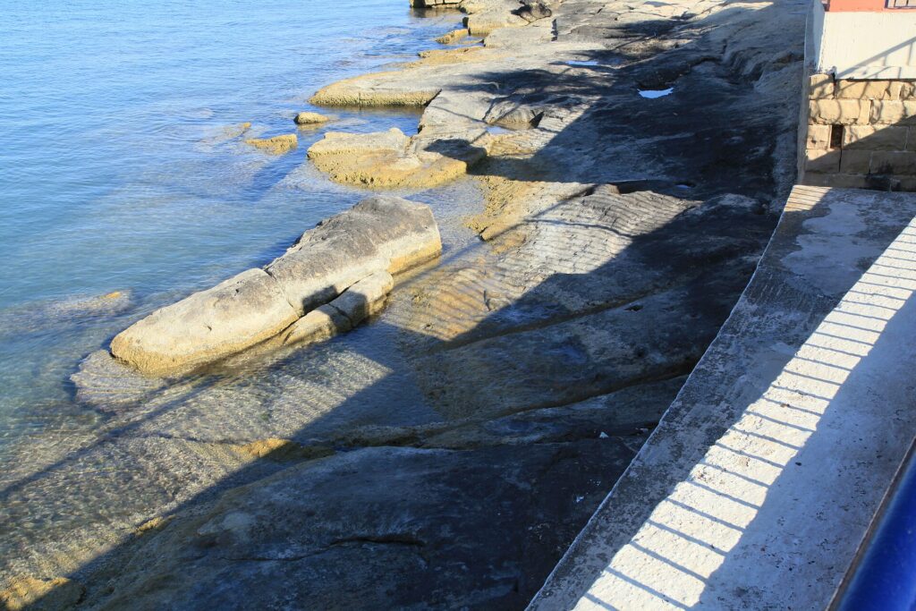
Among the most intriguing examples are grooves at il-Bajja ta’ San Ġorġ in Birżebbuġa, where a pair of tracks approaches the shoreline and continues below the present water level. Their submerged position has sometimes encouraged interpretations placing their construction in a much earlier prehistoric landscape. If the routes originally crossed dry ground, their disappearance beneath the sea might appear to indicate dramatic environmental changes.
However, Grima argues that the evidence does not require such an ancient explanation. Sea level around Malta has risen approximately 1.3 meters over the past two millennia, while the submerged grooves extend only about 30 centimeters below the present mean sea level. Their position is therefore compatible with a route that remained usable during Classical antiquity.
The surrounding coastline has also changed as waves and currents redistributed sediments. Areas that once supported roads or tracks may have eroded, leaving portions of the original routes submerged or missing. The researcher suggests that some grooves could have continued across former beach deposits before those surfaces disappeared.
Rather than establishing a prehistoric date, the submerged tracks illustrate how coastal erosion and changing sea levels can complicate archaeological interpretations.
How Did Ancient Vehicles Create Such Deep Grooves?
The study also addresses one of the most persistent questions surrounding Malta’s cart ruts: how repeated movement produced channels that sometimes extend deeply into solid limestone. Some earlier explanations proposed that workers deliberately carved the grooves to guide vehicles. Others suggested that repeated traffic gradually wore them into the rock.
Grima favors an interpretation involving wheeled vehicles traveling repeatedly along established routes. Roman carts commonly used metal-rimmed wheels capable of wearing hard road surfaces, and comparable grooves survive in the basalt streets of Pompeii. Some Pompeian tracks reached depths exceeding 20 centimeters despite the considerable hardness of the volcanic stone.
The Maltese tracks may initially have developed beneath shallow soil cover, with vehicle wheels gradually wearing into the underlying limestone. As grooves deepened and became difficult to navigate, travelers could have established alternative routes nearby. Over generations, this process may have produced the overlapping networks visible at several archaeological sites.
The absence of obvious hoof marks beside many grooves does not necessarily contradict this explanation. Animals pulling Roman vehicles may have traveled without metal horseshoes, leaving fewer permanent traces than the wheels themselves.
A Centuries-Old Mystery Reconsidered
Grima’s research does not claim that every Maltese cart rut dates to the Roman period or that all remaining questions have been resolved. The available evidence indicates that the formations developed over different periods, potentially spanning many centuries. Although some tracks can be confidently associated with Roman activity, earlier origins for individual routes cannot be entirely excluded.
The investigation nevertheless changes the historical framework through which these unusual formations can be understood. Rather than treating them as an isolated prehistoric mystery, the study places much of the network within the economic and transportation systems of ancient Malta. Farms, quarries, burial grounds, towns, and harbors together provide a setting in which repeated wheeled traffic could have produced the surviving tracks.
For the first time, an island-wide assessment brings together thousands of routes and their archaeological surroundings to test competing explanations. The result does not eliminate every uncertainty, but it substantially strengthens the evidence that Malta’s mysterious stone tracks were part of the everyday movement of people and goods during Classical antiquity.
Grima, J. (2026). The chronology of the Maltese cart ruts: A critical evaluation of the available dating evidence. Journal of Archaeological Science: Reports, 76, Article 106134. https://doi.org/10.1016/j.jasrep.2026.106134
