For more than a thousand years, the precise location of Madinat al-Zāhira, the enigmatic palace-city founded by Almanzor (al-Mansur Ibn Abi Aamir) in the 10th century, has remained one of the most debated mysteries of Islamic archaeology in Spain. A new study by Antonio Monterroso Checa, a researcher at the University of Córdoba, now presents the strongest physical evidence so far, identifying a possible location at the eastern edge of Córdoba, near Alcolea.
Using advanced LiDAR (Light Detection and Ranging) technology, the research provides measurable, verifiable data that may finally resolve a long-standing historiographical debate.
Why Madinat al-Zāhira Matters
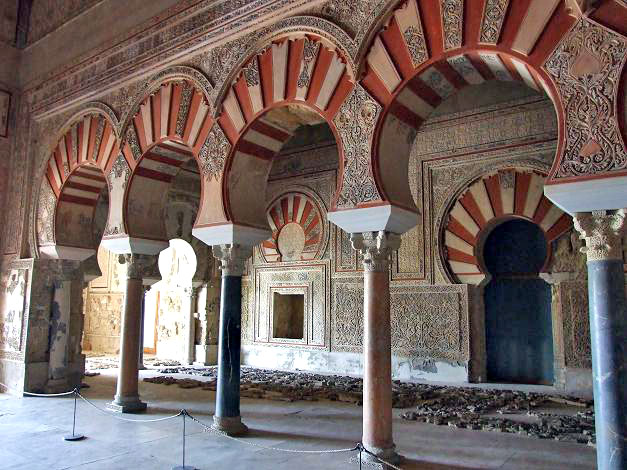
Madinat al-Zāhira was not just another urban settlement. Built by Almanzor at the height of his power, it functioned as the political and administrative heart of al-Andalus during the final decades of the Umayyad Caliphate. Medieval sources describe it as a monumental city designed to rival Madinat al-Zahra, the famous caliphal city founded by Abd al-Rahman III.
Unlike Madinat al-Zahra, however, Madinat al-Zāhira disappeared almost completely after Almanzor’s fall, likely dismantled and reused as building material. Its disappearance turned it into a topographical enigma, inspiring more than twenty different hypotheses regarding its location—none supported by solid physical evidence until now.
LiDAR Technology and a New Archaeological Approach
The breakthrough comes from the use of open-access LiDAR data provided by Spain’s National Geographic Institute (IGN). LiDAR allows researchers to detect subtle variations in terrain by penetrating vegetation and revealing hidden surface anomalies invisible to the naked eye.
📣 Our WhatsApp channel is now LIVE! Stay up-to-date with the latest news and updates, just click here to follow us on WhatsApp and never miss a thing!!
Monterroso Checa analyzed high-resolution digital elevation models generated from the third national LiDAR coverage, which offers significantly greater detail than earlier datasets. These models were then interpreted through a combination of historical analysis, medieval textual sources, and urban morphology.
This interdisciplinary methodology represents a shift away from speculative theories toward data-driven archaeological research.

Location of the lost city of Madinat Al-Zahira in Córdoba identified. Credit: Monterroso Checa, A. (2026) / Universidad de Córdoba, IGN
The Pendolillas Hills: Key Physical Evidence
The study identifies a large area near the Pendolillas hills, east of Córdoba and approximately 12 kilometers from the Great Mosque, as the most likely location of Madinat al-Zāhira. This area exhibits linear and geometric anomalies extending over more than 1,200 meters, consistent with buried architectural structures.
According to the LiDAR data, these anomalies form a planned urban layout characterized by:
Rectangular and square building footprints
A terraced architectural organization adapted to the terrain
Sections of orthogonal urban planning, with some structures oriented toward the southeast
The total estimated area reaches approximately 120 hectares, matching the size of Madinat al-Zahra and reinforcing the idea that Madinat al-Zāhira was conceived as an equally monumental city.
Historical Continuity and Strategic Location
The identified area also presents a remarkable historical continuity closely linked to centers of power, reinforcing its interpretation as the site of Madinat al-Zāhira. From at least the 15th century onward, the land is documented as a dehesa directly associated with the Royal Domain (Realengo). During the reign of Philip II, it further gained strategic importance as the seat of the Royal Stud Farms (Yeguadas Reales).
This long-standing association with royal authority is particularly significant. Together with the area surrounding Madinat al-Zahra, the Pendolillas sector constitutes one of only two documented Royal Dehesas within the municipal boundaries of Córdoba. Such a status suggests not a random rural landscape, but a territory of exceptional political and symbolic value, repeatedly selected by ruling powers across different historical periods.
The study integrates this historical evidence into its interpretive framework, placing it in dialogue with medieval historiographic and literary sources that describe al-Zāhira as a carefully chosen and strategically positioned city. The persistence of royal control over the land strengthens the argument that this location retained its prestige and functionality long after the physical structures of the Umayyad city disappeared.
As a result, the proposed identification of Madinat al-Zāhira does not rely solely on technological innovation. Instead, it emerges from the convergence of cutting-edge LiDAR analysis and critical engagement with written sources, demonstrating how advanced digital archaeology and traditional historical scholarship can mutually reinforce one another in resolving one of the most enduring enigmas of al-Andalus.
Why This Hypothesis Is Different
What sets this proposal apart from previous theories is its reliance on verifiable physical data rather than literary interpretation alone. Of the more than twenty existing hypotheses regarding Madinat al-Zāhira’s location, this is the only one supported by measurable terrain evidence.
The same LiDAR-based methodology has already enabled the identification of hundreds of archaeological sites across the province of Córdoba by the University of Córdoba’s Patricia Research Unit, demonstrating its reliability and scalability.
Implications for the Archaeology of al-Andalus
If confirmed through excavation, this discovery would significantly reshape our understanding of urban planning, political power, and landscape management in late Umayyad al-Andalus. It would also open new avenues for:
Archaeological research and heritage preservation
Cultural tourism in eastern Córdoba
Reassessment of medieval Islamic urban networks
Most importantly, it moves Madinat al-Zāhira from legend toward scientifically grounded historical reality.
From Legend to Landscape: Rethinking a Thousand-Year-Old Mystery
The identification of a possible location for Madinat al-Zāhira near Alcolea represents a major step forward in Andalusi archaeology. By combining LiDAR technology, historical scholarship, and landscape analysis, the University of Córdoba’s research offers the most convincing solution yet to a mystery that has endured for centuries.
As future archaeological work builds on these findings, the lost city of Almanzor may finally emerge from the terrain—revealed not by chance, but by data.
Monterroso Checa, A. (2026), “Propuesta de ubicación de Madinat Al-Zāhira en el extremo este de Córdoba”, Meridies 15-16 (2024-2025), pp. 98-139. https://journals.uco.es/meridies/issue/view/1376/303
Cover Image Credit: The possible location of Madinat Al-Zahira at the eastern end of Córdoba (to the west, Madinat Al-Zhara). Monterroso Checa, A. (2026) / Universidad de Córdoba